IMAGES TAKEN NEAR TO
Sturges Road, EXMOUTH, EX8 4BH
Introduction
This page details the photographs taken nearby to Sturges Road, EX8 4BH by members of the Geograph project.
The Geograph project started in 2005 with the aim of publishing, organising and preserving representative images for every square kilometre of Great Britain, Ireland and the Isle of Man.

There are currently over 7.5m images from over14,400 individuals and you can help contribute to the project by visiting https://www.geograph.org.uk
Image Map
Images are licensed for reuse under creativecommons.org/licenses/by-sa/2.0
Notes
- Clicking on the map will re-center to the selected point.
- The higher the marker number, the further away the image location is from the centre of the postcode.
Image Listing (21 Images Found)
Images are licensed for reuse under creativecommons.org/licenses/by-sa/2.0
Image
Details
Distance
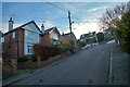
1
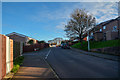
Exmouth : Masey Road
Looking along Masey Road with Cumberland Road heading off to the left.
Image: © Lewis Clarke
Taken: 3 Dec 2019
0.04 miles
2

Exmouth : Masey Road
Looking along Masey Road.
Image: © Lewis Clarke
Taken: 3 Dec 2019
0.04 miles
3
Exmouth : Masey Road
Looking along Masey Road.
Image: © Lewis Clarke
Taken: 3 Dec 2019
0.06 miles
4
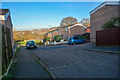
Exmouth : Cumberland Close
Looking along Cumberland Close off Masey Road.
Image: © Lewis Clarke
Taken: 3 Dec 2019
0.06 miles
5

Exmouth : Heard Avenue
Looking along Heard Avenue off Masey Road.
Image: © Lewis Clarke
Taken: 3 Dec 2019
0.08 miles
7

Exmouth : Dukes Close
Looking along Dukes Close off Prince of Wales Drive.
Image: © Lewis Clarke
Taken: 3 Dec 2019
0.11 miles
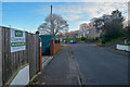
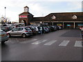
8
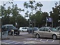
Salterton Road Supermarket Carpark
Image: © Sarah Charlesworth
Taken: 11 Sep 2008
0.14 miles
9

Exmouth : Footpath
A footpath off Prince of Wales Drive to Dukes Crescent.
Image: © Lewis Clarke
Taken: 3 Dec 2019
0.15 miles
10
Exmouth : Masey Road
Looking along Masey Road in Exmouth.
Image: © Lewis Clarke
Taken: 3 Dec 2019
0.15 miles