
IMAGES TAKEN NEAR TO
Lestock Close, EXMOUTH, EX8 2QW
Introduction
This page details the photographs taken nearby to Lestock Close, EX8 2QW by members of the Geograph project.
The Geograph project started in 2005 with the aim of publishing, organising and preserving representative images for every square kilometre of Great Britain, Ireland and the Isle of Man.

There are currently over 7.5m images from over14,400 individuals and you can help contribute to the project by visiting https://www.geograph.org.uk
Image Map
Images are licensed for reuse under creativecommons.org/licenses/by-sa/2.0
Notes
- Clicking on the map will re-center to the selected point.
- The higher the marker number, the further away the image location is from the centre of the postcode.
Image Listing (37 Images Found)
Images are licensed for reuse under creativecommons.org/licenses/by-sa/2.0
Image
Details
Distance
1

Cycle path near Bidmead Close
The path runs along the former Exmouth to Budleigh Salterton Railway which is part of National Cycle Network route 2.
Image: © DS Pugh
Taken: 4 Jul 2025
0.02 miles
2
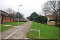
Cycleway 2 comes off John Hudson Way, Littleham
Image: © N Chadwick
Taken: 30 Dec 2008
0.03 miles
3

Hectors House, Littleham, Exmouth
Small business accommodation in the Pankhurst Close area of Littleham, Exmouth. Pankhurst Close is named after Pankhurst Engineering, whose factory (demolished early 2019) was behind the photographer
Image: © David Wickham
Taken: 17 Apr 2019
0.09 miles
5

Exmouth : Footpath
The Exmouth to Budleigh Salterton Railway Path is a nice easy cycle or walk along the disused railway path running from Exmouth to Budleigh Salterton. It runs along National Cycle route 2 through rolling countryside and woodland.
Image: © Lewis Clarke
Taken: 3 Dec 2019
0.10 miles
6
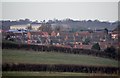
Exmouth : Houses in Exmouth
Looking towards houses on the outskirts of Exmouth from Maer Lane.
Image: © Lewis Clarke
Taken: 12 Dec 2010
0.11 miles
7

Pavement along Littleham Road
National Cycle Network route 2 runs along the pavement before turning left ahead.
Image: © DS Pugh
Taken: 4 Jul 2025
0.12 miles
8

Capel Lane bridges
The path runs along the former Exmouth to Budleigh Salterton Railway which is part of National Cycle Network route 2.
Image: © DS Pugh
Taken: 4 Jul 2025
0.13 miles
9

Footbridge and road bridge crossing old railway route
The footbridge is a good example of a Southern Railway prefabricated reinforced concrete structure that is still in very good condition
Image: © Rob Purvis
Taken: 26 Jul 2025
0.13 miles
10
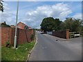
Capel Lane railway bridge
The bridge crosses the former railway line, now part of NCN2 (here named John Hudson Way). The view from the former line is in Image
Image: © David Smith
Taken: 1 Jul 2011
0.13 miles