
IMAGES TAKEN NEAR TO
Ashleigh Road, EXMOUTH, EX8 2JZ
Introduction
This page details the photographs taken nearby to Ashleigh Road, EX8 2JZ by members of the Geograph project.
The Geograph project started in 2005 with the aim of publishing, organising and preserving representative images for every square kilometre of Great Britain, Ireland and the Isle of Man.

There are currently over 7.5m images from over14,400 individuals and you can help contribute to the project by visiting https://www.geograph.org.uk
Image Map
Images are licensed for reuse under creativecommons.org/licenses/by-sa/2.0
Notes
- Clicking on the map will re-center to the selected point.
- The higher the marker number, the further away the image location is from the centre of the postcode.
Image Listing (23 Images Found)
Images are licensed for reuse under creativecommons.org/licenses/by-sa/2.0
Image
Details
Distance
1
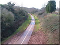
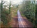
Cycleway on disused railway, Exmouth
The Exmouth-Budleigh cycle track running between Exmouth housing estates which make up most of this square. See also http://www.geograph.org.uk/photo/134667 . View from footbridge to WSW. 11:23 am
Image: © Derek Harper
Taken: 9 Mar 2006
0.04 miles
2

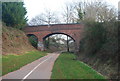
Footpath to cyclepath south of Phear Park
The former railway line from Exmouth to Budleigh Salterton is now a cyclepath. The small bridge provides access from a flight of steps leading to Ashleigh Road
Image: © David Smith
Taken: 1 Sep 2012
0.10 miles
4
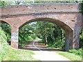
Road bridge over NCN2 (former railway line)
The cycleway is shared with a footpath and in this area is divided by a centre line as the path is heavily used by both pedestrians and cyclists.
Image: © David Smith
Taken: 23 Apr 2011
0.13 miles
5
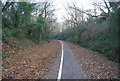
The old Exmouth to Budleigh Salterton Railway (2)
Image: © N Chadwick
Taken: 30 Dec 2008
0.13 miles
6

Cycleway 2 crossing Phear Park
In the background is a derelict farm, which presumably predated the development of the housing around Phear Park
Image: © David Smith
Taken: 23 Apr 2011
0.13 miles
7
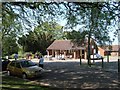
Phear Park cafeteria and ice cream shop
Image: © David Smith
Taken: 23 Apr 2011
0.15 miles

10

Chichester Close, Exmouth
The view in Image] with the sun out.
Image: © Derek Harper
Taken: 9 Mar 2006
0.19 miles