
IMAGES TAKEN NEAR TO
Lower Knoll, Douglas Avenue, EXMOUTH, EX8 2JE
Introduction
This page details the photographs taken nearby to Lower Knoll, Douglas Avenue, EX8 2JE by members of the Geograph project.
The Geograph project started in 2005 with the aim of publishing, organising and preserving representative images for every square kilometre of Great Britain, Ireland and the Isle of Man.

There are currently over 7.5m images from over14,400 individuals and you can help contribute to the project by visiting https://www.geograph.org.uk
Image Map
Images are licensed for reuse under creativecommons.org/licenses/by-sa/2.0
Notes
- Clicking on the map will re-center to the selected point.
- The higher the marker number, the further away the image location is from the centre of the postcode.
Image Listing (20 Images Found)
Images are licensed for reuse under creativecommons.org/licenses/by-sa/2.0
Image
Details
Distance
1

Cranford Avenue junction from Douglas Avenue
Image: © John Firth
Taken: 10 Jun 2014
0.03 miles
2
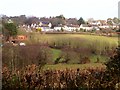
Littleham Brook valley
A view from Maer Lane, with alders by the stream. The trees climbing the far side are along Meetways Lane, carrying Exmouth Footpath 7. The houses are on Douglas Avenue.
Image: © Derek Harper
Taken: 9 Mar 2006
0.04 miles
3
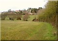
Littleham Brook valley
From Exmouth Footpath 7 following Meetways Lane to the footbridge shown in Image
Image: © Derek Harper
Taken: 9 Mar 2006
0.10 miles
4
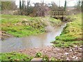
Littleham Brook
Looking upstream to the footbridge shown in Image], carrying Exmouth Footpath 7. A ford for farm vehicles is in the foreground.
Image: © Derek Harper
Taken: 9 Mar 2006
0.10 miles
5

Littleham Brook near Maer Farm
A ford and footbridge over the stream that crosses the centre of this square. Houses in one of the smarter suburbs of Exmouth are in the background. Looking roughly WNW.
Image: © Derek Harper
Taken: 9 Mar 2006
0.12 miles
6
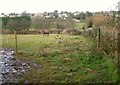
Field, Maer Farm
From Maer Lane. Across the Littleham Brook valley are houses on Douglas Avenue.
Image: © Derek Harper
Taken: 9 Mar 2006
0.16 miles
7

Douglas Road near Cranford Avenue
Douglas Road runs between Salterton Road and Cranford Avenue. This is a second junction with the south end of Cranford Avenue.
Image: © DS Pugh
Taken: 4 Jul 2025
0.17 miles
8

Merrion Avenue, Exmouth and the Littleham valley
Image: © David Smith
Taken: 11 Jun 2014
0.17 miles
9
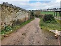
Farm Track
A farm track and public footpath that leads from Maer Lane and through Maer Farm, situated on the east side of Exmouth in devon.
Image: © John P Reeves
Taken: 18 Mar 2023
0.18 miles
10
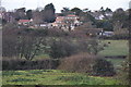
East Devon : Exmouth Outskirts
Fields and houses on the hillside taken from Maer Lane.
Image: © Lewis Clarke
Taken: 12 Dec 2010
0.20 miles