
IMAGES TAKEN NEAR TO
Cranford Close, EXMOUTH, EX8 2HR
Introduction
This page details the photographs taken nearby to Cranford Close, EX8 2HR by members of the Geograph project.
The Geograph project started in 2005 with the aim of publishing, organising and preserving representative images for every square kilometre of Great Britain, Ireland and the Isle of Man.

There are currently over 7.5m images from over14,400 individuals and you can help contribute to the project by visiting https://www.geograph.org.uk
Image Map
Images are licensed for reuse under creativecommons.org/licenses/by-sa/2.0
Notes
- Clicking on the map will re-center to the selected point.
- The higher the marker number, the further away the image location is from the centre of the postcode.
Image Listing (13 Images Found)
Images are licensed for reuse under creativecommons.org/licenses/by-sa/2.0
Image
Details
Distance
1
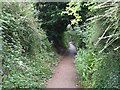
Lime Kiln Lane
Old sunken lane running inland from the site of the lime kilns on the Maer. Now used as a footpath.
Image: © Sarah Charlesworth
Taken: 5 Aug 2008
0.10 miles
2

Cranford Cottage Salterton Road
The black former post box may well be a later addition as there is a Georgian pillar box a few yards up the road.
Image: © Anthony Vosper
Taken: 5 Feb 2017
0.16 miles
3

Douglas Road near Cranford Avenue
Douglas Road runs between Salterton Road and Cranford Avenue. This is a second junction with the south end of Cranford Avenue.
Image: © DS Pugh
Taken: 4 Jul 2025
0.16 miles
4
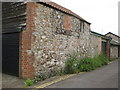
Raddenstile Lane. What was it originally?
A close up of possibly a farm building. Shows a blocked doorway with a large wooden lintel still in place.
Image: © Anthony Vosper
Taken: 26 Jun 2016
0.19 miles
5

Mystery building Raddenstile Lane
Whilst now a garage facing the main road.
This building originally had an entrance at the side.
See Image for a more detailed picture.
Image: © Anthony Vosper
Taken: 26 Jun 2016
0.19 miles
6
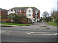
Bronte Court, Salterton Road
A private retirement and sheltered accommodation complex.
A Google search did not throw up any obvious connection for the Brontes and Exmouth.
Image: © Anthony Vosper
Taken: 5 Feb 2017
0.20 miles
7

Douglas Avenue near Isca Road
Douglas Road runs between Salterton Road and Cranford Avenue.
Image: © DS Pugh
Taken: 4 Jul 2025
0.20 miles
8
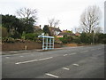
Nobody waiting
A deserted bus stop on the B3178 Salterton Road.
Image: © Anthony Vosper
Taken: 5 Feb 2017
0.21 miles

10
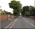
North along Cyprus Road, Exmouth
From Gordon Avenue along Cyprus Road towards Maer Vale and Salterton Road.
Image: © Jaggery
Taken: 16 Jul 2017
0.23 miles