
IMAGES TAKEN NEAR TO
Stewart Gardens, DAWLISH, EX7 0BQ
Introduction
This page details the photographs taken nearby to Stewart Gardens, EX7 0BQ by members of the Geograph project.
The Geograph project started in 2005 with the aim of publishing, organising and preserving representative images for every square kilometre of Great Britain, Ireland and the Isle of Man.

There are currently over 7.5m images from over14,400 individuals and you can help contribute to the project by visiting https://www.geograph.org.uk
Image Map
Images are licensed for reuse under creativecommons.org/licenses/by-sa/2.0
Notes
- Clicking on the map will re-center to the selected point.
- The higher the marker number, the further away the image location is from the centre of the postcode.
Image Listing (86 Images Found)
Images are licensed for reuse under creativecommons.org/licenses/by-sa/2.0
Image
Details
Distance
1

Building site off Old Gatehouse Road
Recent aerial photography showed buildings on this site, so it was clearly a "brownfield" rather than a "greenfield" development.
Image: © Stephen Craven
Taken: 26 Sep 2010
0.03 miles
2
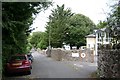
Oak Park Villas, Dawlish
A private road in North Dawlish with substantial 19th century villas on the south-east side, here on the right, and rather secluded 20th century houses and flats on the north-west side. The villas include two care homes and one college.
Image: © Robin Stott
Taken: 19 Jul 2009
0.04 miles
3
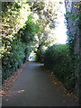
Old Gatehouse Road
A single-track road, looking downhill from the right-angle bend.
Image: © Stephen Craven
Taken: 26 Sep 2010
0.05 miles
4
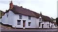
Thatched roof with thatched peacocks
House in Dawlish. Note the effigies of the peacocks on the roof ridge.
Image: © Len Williams
Taken: 18 Dec 2015
0.06 miles
5

Old Gatehouse Road, Dawlish
Stanmore Rise to the left is a short dead-end residential street.
Image: © Stephen Craven
Taken: 27 Oct 2019
0.06 miles
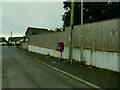
7
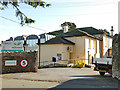
Oakwood Court College, Dawlish
The college occupies one of the 19th century villas along the east side of Oak Park Road. It offers vocational courses for students with learning or physical disabilities.
Image: © Stephen Craven
Taken: 27 Oct 2019
0.08 miles
8
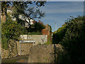
Leyfield Walk, off Gatehouse Hill
Gatehouse Hill would have been a country lane until relatively recently but now has several housing developments along its length including this one (Gatehouse Close). From old maps it is evident that the footpath follows the line of an old field boundary of which no other trace remains.
Image: © Stephen Craven
Taken: 27 Oct 2019
0.08 miles
9
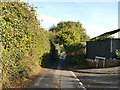
Junction of Wallace Avenue and Gatehouse Hill
Gatehouse Hill would have been a country lane until relatively recently but now has several housing developments along its length.
Image: © Stephen Craven
Taken: 27 Oct 2019
0.09 miles
10

Footpaths near Wallace Avenue
To the right the path heads to Strand Hill with Wallace Avenue ahead.
Image: © DS Pugh
Taken: 3 Jul 2025
0.09 miles