IMAGES TAKEN NEAR TO
Lumley Close, EXETER, EX6 8HT
Introduction
This page details the photographs taken nearby to Lumley Close, EX6 8HT by members of the Geograph project.
The Geograph project started in 2005 with the aim of publishing, organising and preserving representative images for every square kilometre of Great Britain, Ireland and the Isle of Man.

There are currently over 7.5m images from over14,400 individuals and you can help contribute to the project by visiting https://www.geograph.org.uk
Image Map
Images are licensed for reuse under creativecommons.org/licenses/by-sa/2.0
Notes
- Clicking on the map will re-center to the selected point.
- The higher the marker number, the further away the image location is from the centre of the postcode.
Image Listing (33 Images Found)
Images are licensed for reuse under creativecommons.org/licenses/by-sa/2.0
Image
Details
Distance
3

Kenton South Town, on the A379 heading for Starcross
Image: © Rob Purvis
Taken: 4 Sep 2009
0.08 miles

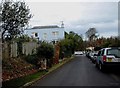
7

Entrance to Powderham Castle shop and lodge
The tiled roof of the lodge uses a variety of tiles, and the chimneys are odd because they are roatated through 45 degrees relative to the house walls
Image: © David Smith
Taken: 28 Apr 2011
0.12 miles
8
Minor road from Southtown to Starcross
On the left are distant views of the Exe estuary
Image: © David Gearing
Taken: 1 Jan 2012
0.16 miles
10
Slittercombe Lane
A country lane running along the northern edge of Kenton village. Beside it on the right are the rears of modern properties on Penhayes Road.
Image: © Derek Harper
Taken: 4 Nov 2009
0.18 miles