IMAGES TAKEN NEAR TO
Kenton, EXETER, EX6 8HJ
Introduction
This page details the photographs taken nearby to EX6 8HJ by members of the Geograph project.
The Geograph project started in 2005 with the aim of publishing, organising and preserving representative images for every square kilometre of Great Britain, Ireland and the Isle of Man.

There are currently over 7.5m images from over14,400 individuals and you can help contribute to the project by visiting https://www.geograph.org.uk
Image Map
Images are licensed for reuse under creativecommons.org/licenses/by-sa/2.0
Notes
- Clicking on the map will re-center to the selected point.
- The higher the marker number, the further away the image location is from the centre of the postcode.
Image Listing (13 Images Found)
Images are licensed for reuse under creativecommons.org/licenses/by-sa/2.0
Image
Details
Distance
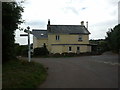
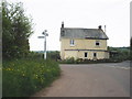
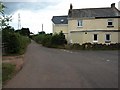
4
The junction at Basket Lodge
This is a staggered crossroads with three roads here and a second junction a few yards to the north.
Image: © David Smith
Taken: 23 Jan 2012
0.01 miles
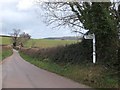
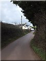
9
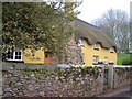
Gulliford
Thatched farmhouse amid a tangle of tiny lanes, looking north.
Image: © Derek Harper
Taken: 20 Apr 2006
0.14 miles
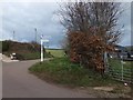
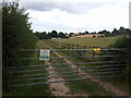
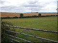
10
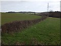
Hedge and fields north of Basket Lodge
The electricity pylon is in Image
Image: © David Smith
Taken: 23 Jan 2012
0.16 miles