IMAGES TAKEN NEAR TO
Kenton, EXETER, EX6 8EZ
Introduction
This page details the photographs taken nearby to EX6 8EZ by members of the Geograph project.
The Geograph project started in 2005 with the aim of publishing, organising and preserving representative images for every square kilometre of Great Britain, Ireland and the Isle of Man.

There are currently over 7.5m images from over14,400 individuals and you can help contribute to the project by visiting https://www.geograph.org.uk
Image Map
Images are licensed for reuse under creativecommons.org/licenses/by-sa/2.0
Notes
- Clicking on the map will re-center to the selected point.
- The higher the marker number, the further away the image location is from the centre of the postcode.
Image Listing (16 Images Found)
Images are licensed for reuse under creativecommons.org/licenses/by-sa/2.0
Image
Details
Distance
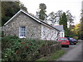
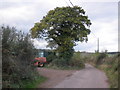
2
Oak Farm
Home to 'River Exe Shellfish'.
Image: © Roger Cornfoot
Taken: 8 Nov 2009
0.03 miles
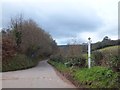
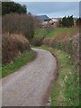
4
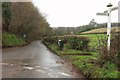
Junction near Oak Farm
See Image; the principal change over five years is that the grit bin has been joined by some form of Lucy pillar.
Image: © Derek Harper
Taken: 1 Feb 2017
0.08 miles