
IMAGES TAKEN NEAR TO
Exeter Road, EXETER, EX6 7UE
Introduction
This page details the photographs taken nearby to Exeter Road, EX6 7UE by members of the Geograph project.
The Geograph project started in 2005 with the aim of publishing, organising and preserving representative images for every square kilometre of Great Britain, Ireland and the Isle of Man.

There are currently over 7.5m images from over14,400 individuals and you can help contribute to the project by visiting https://www.geograph.org.uk
Image Map
Images are licensed for reuse under creativecommons.org/licenses/by-sa/2.0
Notes
- Clicking on the map will re-center to the selected point.
- The higher the marker number, the further away the image location is from the centre of the postcode.
Image Listing (51 Images Found)
Images are licensed for reuse under creativecommons.org/licenses/by-sa/2.0
Image
Details
Distance
1
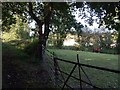
Paddock by the Kenn
The pony is in a small triangular field, heavily shaded by hedgerow trees, and a mere corner of what may have been a larger field before the advent of Kennford's bypasses. The track on the left is a continuation of Bulford Lane from Kennford, carrying Kenn Footpath 6, and again truncated by the A38. A curious, secret spot, yards away from the thunderous noise of the dual carriageway.
Image: © Derek Harper
Taken: 25 Sep 2007
0.02 miles
2
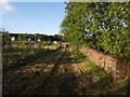
Track beside A38
See Image; this view looks in the opposite direction. The wall on the right is the parapet of a bridge over the River Kenn. On the left is the A38 dual carriageway.
Image: © Derek Harper
Taken: 25 Sep 2007
0.02 miles
3

Track beside A38
I think this must be the line of the A38 as it originally bypassed Kennford, before the dual carriageway was built a few yards to the west. It now seems to be used as a footpath and cycleway. Seen from where the path from Bulford Lane emerges into the open.
Image: © Derek Harper
Taken: 25 Sep 2007
0.04 miles
4
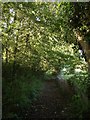
Kenn Footpath 6
The footpath approaches the scene in Image, having crossed a small tributary of the Kenn. Image is a mere 10 metres or so to the left.
Image: © Derek Harper
Taken: 25 Sep 2007
0.04 miles
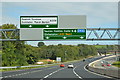
7

In 1929 known as Highway Motors
Soon after this photo was taken the new Highway bypass (A38) diverted traffic away from going through Kennford and thus no more petrol sales. Not to be outdone my father then built the "Wobbly Wheel" a new petrol filling station at the corner of the old village main road and the new Highway bypass - see Image and Image
Image: © Ronald Loach
Taken: Unknown
0.07 miles
8

1931/1932 The Wobbly Wheel
The Wobbly Wheel was used as an example by the Devon Planning Authorities of what a good layout for a Petrol Filling Station should be like.
Once the Station was operational Ronald Loach, the owner and developer, was off again building another petrol filling station on the A38 at the bottom of Redhill near Wrington in Somerset called Paradise Roadhouse http://www.geograph.org.uk/photo/890220 . See also Image
Image: © Ronald Loach
Taken: Unknown
0.08 miles
9
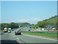
A38 passing Kennford and construction work
Image: © David Smith
Taken: 21 Apr 2011
0.08 miles
10
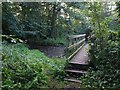
Bridge over stream, Kennford
The footbridge provides Kenn Footpath 6 with access from its Bulford Lane section past the section shown in Image, to its emergence at Image The stream is a tributary of the River Kenn.
Image: © Derek Harper
Taken: 25 Sep 2007
0.08 miles