
IMAGES TAKEN NEAR TO
Higher Ashton, EXETER, EX6 7QY
Introduction
This page details the photographs taken nearby to EX6 7QY by members of the Geograph project.
The Geograph project started in 2005 with the aim of publishing, organising and preserving representative images for every square kilometre of Great Britain, Ireland and the Isle of Man.

There are currently over 7.5m images from over14,400 individuals and you can help contribute to the project by visiting https://www.geograph.org.uk
Image Map
Images are licensed for reuse under creativecommons.org/licenses/by-sa/2.0
Notes
- Clicking on the map will re-center to the selected point.
- The higher the marker number, the further away the image location is from the centre of the postcode.
Image Listing (59 Images Found)
Images are licensed for reuse under creativecommons.org/licenses/by-sa/2.0
Image
Details
Distance
1

Haldon Belvedere spiral staircase
In the castle is a beautiful staircase. This leads past rentable accommodation, and a hall where marriages take place and continues up to the roof where you can see as far as The River Exe and Exeter.
Image: © paul dickson
Taken: 1 Mar 2009
0.01 miles
2

Path below Haldon Belvedere
A little further along Dunchideock footpath 1 from where Image] was taken.
Image: © Derek Harper
Taken: 17 May 2018
0.04 miles
3

Woodland below Haldon Belvedere
Looking right from the stretch of path shown in Image], with some stacked brushwood.
Image: © Derek Harper
Taken: 17 May 2018
0.04 miles
4

Path near Haldon Belvedere
Dunchideock footpath 1 heads into woodland.
Image: © Derek Harper
Taken: 17 May 2018
0.05 miles

7

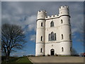
Path to Haldon Gate
Dunchideock footpath 1 climbs through woodland past ferns.
Image: © Derek Harper
Taken: 17 May 2018
0.07 miles
8
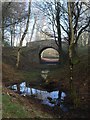
Bridge, Haldon Belvedere
This bridge, across which a grassy track runs, has been better revealed after restoration and clearance work in the surrounding grounds of Image This must be the "late C18 rustic flint bridge" mentioned by Cherry and Pevsner, so dating from the same era as the tower. "The bridge is probably part of a Romantic woodland walk". http://www.imagesofengland.org.uk/Details/Default.aspx?id=352071&mode=adv , which gives more details of construction.
Image: © Derek Harper
Taken: 9 Feb 2008
0.07 miles
9

Haldon Belvedere, Dunchideock (before the restoration) c.1965
Also known as Lawrence Castle, a memorial tower dating back to the late 18th century, it commemorates and celebrates a friend of the Palk family who lived at Haldon until 1892. Their friend was Major-General Stringer Lawrence commander of the British Army in India who died in 1775. The Grade II listed building is located in a solitary position upon a knoll in the civil parish of Dunchideock, and enjoys beautiful panoramic views in all directions. The main restoration of the tower was completed during the 1990s.
The restored tower: https://www.geograph.org.uk/photo/1226333
Image: © Ronald Searle
Taken: Unknown
0.07 miles
10

Lawrence Castle / Haldon Belvedere
See Image]; this was taken a little further north on the same day. The grade II* listed building is described at https://www.historicengland.org.uk/listing/the-list/list-entry/1097067 .
Image: © Derek Harper
Taken: 31 Mar 2006
0.08 miles