
IMAGES TAKEN NEAR TO
Christow, EXETER, EX6 7QH
Introduction
This page details the photographs taken nearby to EX6 7QH by members of the Geograph project.
The Geograph project started in 2005 with the aim of publishing, organising and preserving representative images for every square kilometre of Great Britain, Ireland and the Isle of Man.

There are currently over 7.5m images from over14,400 individuals and you can help contribute to the project by visiting https://www.geograph.org.uk
Image Map
Images are licensed for reuse under creativecommons.org/licenses/by-sa/2.0
Notes
- Clicking on the map will re-center to the selected point.
- The higher the marker number, the further away the image location is from the centre of the postcode.
Image Listing (39 Images Found)
Images are licensed for reuse under creativecommons.org/licenses/by-sa/2.0
Image
Details
Distance
1
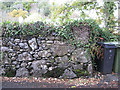
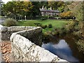
Boundary wall, Byteign Cottage
By the lane to Coombe Image
Image: © Robin Stott
Taken: 30 Oct 2010
0.02 miles
2
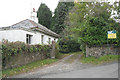
Byteign Lodge
For sale. By the lane to Coombe Image The drive goes straight to the North Lodge of Canonteign House, a considerably shorter distance than the route via Coombe.
Image: © Robin Stott
Taken: 30 Oct 2010
0.04 miles
3
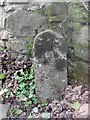
Bridge Marker beside the road from Lower Ashton to Coombe, Christow parish
County Bridge Marker 100 metres southwest of Spara Bridge, River Teign, by a farm gate on the northwest side of the road from Lower Ashton to Coombe. Christow parish. The stone marks the extent of roadway adjoining the bridge that the County was obliged to maintain.
Milestone Society National ID: DV_LASMH01br
Image: © T Jenkinson
Taken: 27 Feb 2011
0.07 miles
4
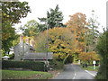
Exmouth Cottages, Spara Bridge
A crossroads on the B3193: on the left the lane from Coombe has descended to the Teign valley floor; the turning on the right is the lane over Spara Bridge to Lower Ashton. The Exmouth name indicates a past connection with the Canonteign estate, as do the mature exotic conifers.
Image: © Robin Stott
Taken: 30 Oct 2010
0.08 miles
6
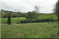
Teign Valley golf course near Byteign Lodge
The view from the lane to Coombe Image This is the part of the course up the hill from the valley floor – see other images in this square. A public footpath goes off to right.
Image: © Robin Stott
Taken: 30 Oct 2010
0.11 miles
7
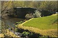
Spara Bridge, Lower Ashton, 2000
Over the River Teign, and also shown, at more recent dates, in http://www.geograph.org.uk/search.php?i=77664952 . The Wikipedia suggestion of 1604 doesn't seem to be borne out by the (grade II*) listed building entry: "1660 (datestone). ... Inscription panel set into upstream parapet, rather decayed but recorded as 'This bridge was builded at the countyes charges Anno 1660'. Jervoise and Henderson quote a 1647 reference that 'Sparrowe Bridge was in Decay'; presumably the present bridge is the replacement" https://www.historicengland.org.uk/listing/the-list/list-entry/1163425 .
Image: © Derek Harper
Taken: 1 May 2000
0.12 miles
9
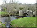
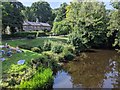
Spara Bridge over the River Teign, Ashton
Image: © Ruth Sharville
Taken: 28 Feb 2016
0.12 miles
10
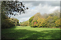
Meadow by the Teign
The river is among trees on the right. The B3193 is among trees on the left.
Image: © Robin Stott
Taken: 30 Oct 2010
0.13 miles