
IMAGES TAKEN NEAR TO
Bridford, EXETER, EX6 7HX
Introduction
This page details the photographs taken nearby to EX6 7HX by members of the Geograph project.
The Geograph project started in 2005 with the aim of publishing, organising and preserving representative images for every square kilometre of Great Britain, Ireland and the Isle of Man.

There are currently over 7.5m images from over14,400 individuals and you can help contribute to the project by visiting https://www.geograph.org.uk
Image Map
Images are licensed for reuse under creativecommons.org/licenses/by-sa/2.0
Notes
- Clicking on the map will re-center to the selected point.
- The higher the marker number, the further away the image location is from the centre of the postcode.
Image Listing (21 Images Found)
Images are licensed for reuse under creativecommons.org/licenses/by-sa/2.0
Image
Details
Distance
1
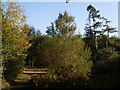
Bridleway in Clampitt Plantation
Christow Bridleway 25 meets Bridleway 23 at a T-junction. As its surface shows, the route crossing is a drivable road at this point as it heads towards the deserted farmstead at Image
Image: © Derek Harper
Taken: 5 Oct 2007
0.07 miles
2
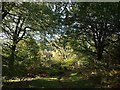
Bridleway in Clampitt Plantation
This part of the wood is an area of deciduous trees of mixed ages, in contrast to the conifers that predominate in the rest. Christow Bridleway 25 curves towards the heart of it.
Image: © Derek Harper
Taken: 5 Oct 2007
0.07 miles
3
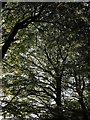
Beeches near Clampitt House
Looking up into the canopy of some fine beech trees beside Christow Bridleway 25, which can actually be seen on the left of Image
Image: © Derek Harper
Taken: 5 Oct 2007
0.08 miles
4
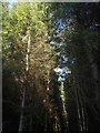
In Clampitt Plantation
Most of the wood consists of lines of conifers. This is taken from Christow Bridleway 25.
Image: © Derek Harper
Taken: 5 Oct 2007
0.10 miles
5
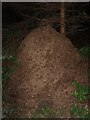
Wood ants' nest, Clampitt Plantation
At first sight, this nest looked to be at least five feet high, but the main part of it is built on a bank beside the bridleway.
Image: © Derek Harper
Taken: 5 Oct 2007
0.10 miles
6
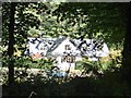
Beacon Farm
From the bridleway is a glimpse through the trees of the farmhouse.
Image: © Michael Dibb
Taken: 24 Sep 2018
0.10 miles
7
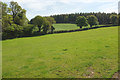
Field near Clampitt
From a gate on the right of the lane shown in Image The hedge is along the no through road leading into Clampitt Plantation on the right.
Image: © Derek Harper
Taken: 17 May 2018
0.17 miles
8
![Three ways to go [3]](https://s1.geograph.org.uk/geophotos/05/92/74/5927457_211441eb_120x120.jpg)
Three ways to go [3]
At the junction of the bridleway and road there are three ways to go. This is the road towards Christow.
Image: © Michael Dibb
Taken: 24 Sep 2018
0.20 miles
9
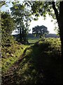
Field access track near Clampitt
A closer look at the track shown in Image Clampitt Plantation is on the horizon.
Image: © Derek Harper
Taken: 5 Oct 2007
0.20 miles
10
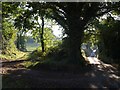
Junction near Clampitt
In fact three of the lanes are not seen. The track on the left just leads into a field below Clampitt Plantation; the lane on the right is a no through road which climbs through the plantation to Clampitt.
Image: © Derek Harper
Taken: 5 Oct 2007
0.22 miles