IMAGES TAKEN NEAR TO
Drewsteignton, EXETER, EX6 6RE
Introduction
This page details the photographs taken nearby to EX6 6RE by members of the Geograph project.
The Geograph project started in 2005 with the aim of publishing, organising and preserving representative images for every square kilometre of Great Britain, Ireland and the Isle of Man.

There are currently over 7.5m images from over14,400 individuals and you can help contribute to the project by visiting https://www.geograph.org.uk
Image Map
Images are licensed for reuse under creativecommons.org/licenses/by-sa/2.0
Notes
- Clicking on the map will re-center to the selected point.
- The higher the marker number, the further away the image location is from the centre of the postcode.
Image Listing (14 Images Found)
Images are licensed for reuse under creativecommons.org/licenses/by-sa/2.0
Image
Details
Distance
3
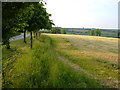
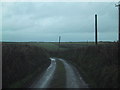
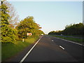
Drive to Grendon Farm
A view alongside the driveway into the farm from its junction with the old A30. Beside it, the rolling countryside of mid Devon.
Image: © Derek Harper
Taken: 6 Jun 2006
0.15 miles
4
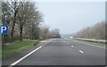
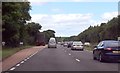
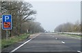
Small layby - A30
This is with 500 metres of an earlier one, most odd.
Image: © Fernweh
Taken: 14 Mar 2014
0.18 miles
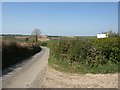
6
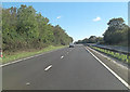
West Devon : The A30
The A30 heading through the county of Devon.
Image: © Lewis Clarke
Taken: 23 Feb 2014
0.19 miles
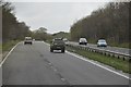
8
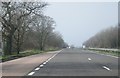
Help on the A30
Perhaps nearby Dartmoor interferes with mobile signals.
Image: © Fernweh
Taken: 14 Mar 2014
0.20 miles