IMAGES TAKEN NEAR TO
Drewsteignton, EXETER, EX6 6QW
Introduction
This page details the photographs taken nearby to EX6 6QW by members of the Geograph project.
The Geograph project started in 2005 with the aim of publishing, organising and preserving representative images for every square kilometre of Great Britain, Ireland and the Isle of Man.

There are currently over 7.5m images from over14,400 individuals and you can help contribute to the project by visiting https://www.geograph.org.uk
Image Map
Images are licensed for reuse under creativecommons.org/licenses/by-sa/2.0
Notes
- Clicking on the map will re-center to the selected point.
- The higher the marker number, the further away the image location is from the centre of the postcode.
Image Listing (114 Images Found)
Images are licensed for reuse under creativecommons.org/licenses/by-sa/2.0
Image
Details
Distance
1

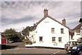
Drewsteignton, 1954
View eastward, to Holy Trinity Church with Drewes Arms Hotel on the left: an identical scene to Image and Image, but about 60 years earlier.
Image: © Ben Brooksbank
Taken: 29 Aug 1954
0.01 miles
2
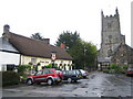
Drewsteignton
This is the centre of Drewsteignton showing Holy Trinity Church and The Drewe Arms public house.
The Drewe Arms was reputedly originally known as The Druid Arms but the name was changed in the 1920s when the Drewe family had nearby Castle Drogo built. The Drewe family persuaded the brewery that owned the pub to change the name, and offered to buy the sign with the family coat of arms which is visible on the inn sign today. The pub's website is here http://www.thedrewearms.co.uk/
Image: © Nigel Cox
Taken: 10 May 2007
0.01 miles
3
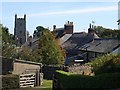
Drewsteignton
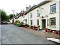
Entering the village from the west, from Drewsteignton Footpath 17. On the right are the roofs of cottages on the north side of Hillmorhay, the street leading down to Image, with the tower of Image on the left.
Image: © Derek Harper
Taken: 11 Sep 2009
0.01 miles
4
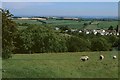
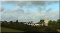
Drewsteignton from Rectory Wood, 2000
A view from Drewsteignton bridleway 13 at the edge of the wood.
Image: © Derek Harper
Taken: 16 Jun 2000
0.01 miles
5
Drewsteignton from Rectory Wood
Looking more to the right than Image], with zoom, picking out the C15 tower of Holy Trinity church https://historicengland.org.uk/listing/the-list/list-entry/1106073 .
Image: © Derek Harper
Taken: 29 Sep 2019
0.01 miles
7
The Drewe Arms, Drewsteignton
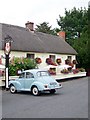
The inn is a Grade II listed and was built in the early 17th century. The building was modernised in the 19th century. The inn as it stands now is a well preserved 19th century inn. The 'Drew' in Drewesteign and the 'Drewe' Arms refers to a Drew or Drogo who owned a farm here in the 13th century.
Image: © Maigheach-gheal
Taken: 9 Jul 2009
0.02 miles
8
Drewsteignton : Village Lane
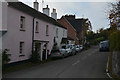
A small lane heading through the village.
Image: © Lewis Clarke
Taken: 1 Nov 2016
0.02 miles
9
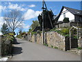
The entrance to Dewsteignton village, from the West
Image: © Roger Cornfoot
Taken: 11 Apr 2009
0.02 miles