
IMAGES TAKEN NEAR TO
Cheriton Bishop, EXETER, EX6 6JQ
Introduction
This page details the photographs taken nearby to EX6 6JQ by members of the Geograph project.
The Geograph project started in 2005 with the aim of publishing, organising and preserving representative images for every square kilometre of Great Britain, Ireland and the Isle of Man.

There are currently over 7.5m images from over14,400 individuals and you can help contribute to the project by visiting https://www.geograph.org.uk
Image Map
Images are licensed for reuse under creativecommons.org/licenses/by-sa/2.0
Notes
- Clicking on the map will re-center to the selected point.
- The higher the marker number, the further away the image location is from the centre of the postcode.
Image Listing (6 Images Found)
Images are licensed for reuse under creativecommons.org/licenses/by-sa/2.0
Image
Details
Distance
3
Holiday log cabins at Lower Eggbeer
These two log cabins are owned by a Christian trust to provide holidays for ministers and missionaries
Image: © David Smith
Taken: 6 Mar 2014
0.11 miles
4

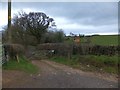
Bare tree by the access road to Higher Eggbeer
Beyond the tree the skyline is the wooded side of the valley of the River Teign
Image: © David Smith
Taken: 6 Mar 2014
0.17 miles
5
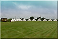
One dozen yurts and a caravan on Higher Eggbeer
Image: © Roger A Smith
Taken: 24 Jul 2021
0.19 miles
6
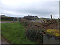
Track to farm and kennels
The sign on the left names this as "Waggy Tails" kennels. The track follows the level summit of a low ridge
Image: © David Smith
Taken: 6 Mar 2014
0.24 miles