IMAGES TAKEN NEAR TO
Bradninch, EXETER, EX5 4LY
Introduction
This page details the photographs taken nearby to EX5 4LY by members of the Geograph project.
The Geograph project started in 2005 with the aim of publishing, organising and preserving representative images for every square kilometre of Great Britain, Ireland and the Isle of Man.

There are currently over 7.5m images from over14,400 individuals and you can help contribute to the project by visiting https://www.geograph.org.uk
Image Map
Images are licensed for reuse under creativecommons.org/licenses/by-sa/2.0
Notes
- Clicking on the map will re-center to the selected point.
- The higher the marker number, the further away the image location is from the centre of the postcode.
Image Listing (18 Images Found)
Images are licensed for reuse under creativecommons.org/licenses/by-sa/2.0
Image
Details
Distance
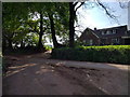
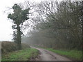
3
Mid Devon : Country Lane
A small country lane between Silverton and Butterleigh.
Image: © Lewis Clarke
Taken: 18 Jan 2014
0.03 miles

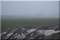
5
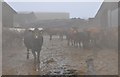
Mid Devon : Cattle at Queensborough Farm
Cattle standing in the fog at Queensborough Farm near Butterleigh.
Image: © Lewis Clarke
Taken: 18 Jan 2014
0.03 miles
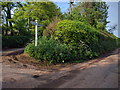
7
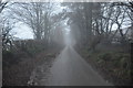
Mid Devon : Country Lane
A country lane heading through the mist from Butterleigh to Silverton.
Image: © Lewis Clarke
Taken: 18 Jan 2014
0.06 miles
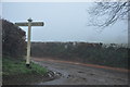
8
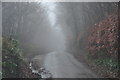
Mid Devon : Country Lane
A country lane heading from Butterleigh to Silverton in Mid Devon.
Image: © Lewis Clarke
Taken: 18 Jan 2014
0.14 miles
9
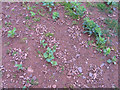
Earthworm stone mounds
These small piles of stones protect the entrance to the deep vertical holes formed by anecic earthworms, such as the Common Earthworm (Lumbricus terrestris). Numerous mounds are seen here on arable land with a thin crop of kale. The soil is a stony medium loam of the Crediton Series, subgroup 5.41, typical brown earths in the national soil classification.
Image: © Rodney Burton
Taken: 8 Mar 2008
0.16 miles
10
Mid Devon : Grassy Field
A grassy field in the Mid Devon countryside.
Image: © Lewis Clarke
Taken: 18 Jan 2014
0.17 miles