IMAGES TAKEN NEAR TO
London Road, EXETER, EX5 2PY
Introduction
This page details the photographs taken nearby to London Road, EX5 2PY by members of the Geograph project.
The Geograph project started in 2005 with the aim of publishing, organising and preserving representative images for every square kilometre of Great Britain, Ireland and the Isle of Man.

There are currently over 7.5m images from over14,400 individuals and you can help contribute to the project by visiting https://www.geograph.org.uk
Image Map
Images are licensed for reuse under creativecommons.org/licenses/by-sa/2.0
Notes
- Clicking on the map will re-center to the selected point.
- The higher the marker number, the further away the image location is from the centre of the postcode.
Image Listing (14 Images Found)
Images are licensed for reuse under creativecommons.org/licenses/by-sa/2.0
Image
Details
Distance
1
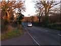
Old A30, the Fosse Way Roman road, heading east
Image: © Rob Purvis
Taken: 17 Dec 2009
0.01 miles
2
A bridge over a minor stream near Hand and Pen
Image: © David Smith
Taken: 20 Jan 2011
0.04 miles
3
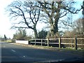
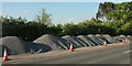
B3174 at Bodley Bridge
The Roman Road crosses a small stream at the bridge. The lay-by here has been filled with gravel heaps. Image was taken from the gate across the road on the right.
Image: © Derek Harper
Taken: 15 May 2016
0.04 miles
4
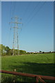
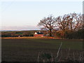
Pylon in field by Bodley Bridge
From a gateway on the Roman road. In the background is Strete Farm.
Image: © Derek Harper
Taken: 15 May 2016
0.06 miles
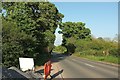
7
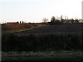
What laybys are for
Parking so that you can take a break and admire the view? Or ponder the existence of the Roman road? (See Image and Image). Nah, let's close it and fill it with gravel - which I'm sure will have some useful purpose.
Image: © Derek Harper
Taken: 15 May 2016
0.08 miles
8
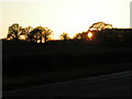
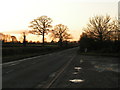
Setting sun through trees seen from the old A30 Roman road
Image: © Rob Purvis
Taken: 17 Dec 2009
0.12 miles
9
Old A30, the Fosse Way Roman road, heading west
Image: © Rob Purvis
Taken: 17 Dec 2009
0.13 miles
10
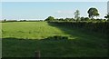
Field boundary near Bodley Bridge
Looking to the right from the same spot as Image, with some overlap. The hedge and fence are followed by the parish boundary between Whimple (this side) and Rockbeare.
Image: © Derek Harper
Taken: 15 May 2016
0.14 miles