IMAGES TAKEN NEAR TO
Harp Lane, EXETER, EX5 2FJ
Introduction
This page details the photographs taken nearby to Harp Lane, EX5 2FJ by members of the Geograph project.
The Geograph project started in 2005 with the aim of publishing, organising and preserving representative images for every square kilometre of Great Britain, Ireland and the Isle of Man.

There are currently over 7.5m images from over14,400 individuals and you can help contribute to the project by visiting https://www.geograph.org.uk
Image Map
Images are licensed for reuse under creativecommons.org/licenses/by-sa/2.0
Notes
- Clicking on the map will re-center to the selected point.
- The higher the marker number, the further away the image location is from the centre of the postcode.
Image Listing (10 Images Found)
Images are licensed for reuse under creativecommons.org/licenses/by-sa/2.0
Image
Details
Distance
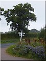
2
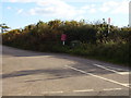
Postbox at Madges Cross
One can only speculate that with the impending changes to the Post Office system how long these isolated boxes will be used.
Image: © Anthony Vosper
Taken: 24 Oct 2010
0.14 miles
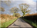
6
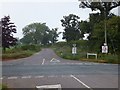
The road to Aylesbeare from Madges Cross
Image: © David Smith
Taken: 1 Aug 2011
0.18 miles
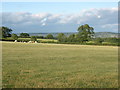
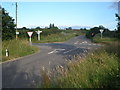
8
A pond in a field
Podgers pit junction.
Close to the B3180 and Harp Lane.
Image: © Anthony Vosper
Taken: 10 Jan 2016
0.21 miles

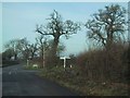
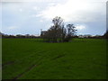
10
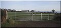
Double Width Gate near Mattocks
Image: © Sarah Charlesworth
Taken: 15 Dec 2008
0.25 miles