
IMAGES TAKEN NEAR TO
Lucas Avenue, EXETER, EX4 6LZ
Introduction
This page details the photographs taken nearby to Lucas Avenue, EX4 6LZ by members of the Geograph project.
The Geograph project started in 2005 with the aim of publishing, organising and preserving representative images for every square kilometre of Great Britain, Ireland and the Isle of Man.

There are currently over 7.5m images from over14,400 individuals and you can help contribute to the project by visiting https://www.geograph.org.uk
Image Map
Images are licensed for reuse under creativecommons.org/licenses/by-sa/2.0
Notes
- Clicking on the map will re-center to the selected point.
- The higher the marker number, the further away the image location is from the centre of the postcode.
Image Listing (249 Images Found)
Images are licensed for reuse under creativecommons.org/licenses/by-sa/2.0
Image
Details
Distance
1
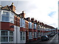
Iddesleigh Road, Exeter
A continuous terrace climbs the hill to the junction with Mount Pleasant Road.
Image: © Derek Harper
Taken: 18 Dec 2006
0.02 miles
2
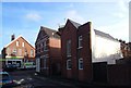
Iddesleigh Road, Exeter
The photo crosses a gridline. The road backs on to the railway line on the left, and performs a double bend here to accommodate housing on the railway side of the road. The building on the right, which is SX9293, seems to have adopted a curious shape to fit in with the road layout - perhaps it pre-dated either the railway or the road.
Image: © Derek Harper
Taken: 12 Dec 2006
0.03 miles
3

May Street, Exeter
A terraced street linking Elmside to Old Tiverton Road.
Image: © Derek Harper
Taken: 5 Jun 2006
0.04 miles
4
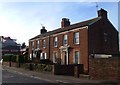
36-37 Old Tiverton Road, Exeter
A pair of Victorian houses with scroll brackets and cornice, backing on to the railway line.
Image: © Derek Harper
Taken: 12 Dec 2006
0.05 miles
5
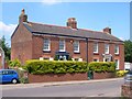
36-37 Old Tiverton Road, Exeter
From a different angle to Image The pair are listed and described at http://www.britishlistedbuildings.co.uk/en-480953-36-and-37-exeter .
Image: © Derek Harper
Taken: 5 Jun 2006
0.05 miles
6

Albion Terrace, Exeter
This terrace of 17 houses off the Old Tiverton Road faces this little alley, with no direct road access.
Image: © Derek Harper
Taken: 28 Feb 2007
0.06 miles
7
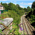
Western portal of Blackboy Tunnel, Exeter
Viewed from Well Street near St James Park railway station. Blackboy Tunnel is 240 metres long.
Image: © Jaggery
Taken: 26 Aug 2016
0.06 miles
8
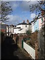
Albion Terrace, Exeter
Image: © Derek Harper
Taken: 28 Feb 2007
0.06 miles
9
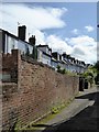
Albion Place, Exeter
A cul-de-sac of 17 houses facing a pedestrian access. The terrace dates from the 1830s and is listed grade II
Image: © David Smith
Taken: 12 Sep 2015
0.06 miles
10

The south end of Rosebery Road, Exeter
"Bery" with one "r" as it is named after the British Prime Minister
Image: © David Smith
Taken: 23 Apr 2020
0.06 miles