
IMAGES TAKEN NEAR TO
Woolsery, BIDEFORD, EX39 5QU
Introduction
This page details the photographs taken nearby to EX39 5QU by members of the Geograph project.
The Geograph project started in 2005 with the aim of publishing, organising and preserving representative images for every square kilometre of Great Britain, Ireland and the Isle of Man.

There are currently over 7.5m images from over14,400 individuals and you can help contribute to the project by visiting https://www.geograph.org.uk
Image Map
Images are licensed for reuse under creativecommons.org/licenses/by-sa/2.0
Notes
- Clicking on the map will re-center to the selected point.
- The higher the marker number, the further away the image location is from the centre of the postcode.
Image Listing (6 Images Found)
Images are licensed for reuse under creativecommons.org/licenses/by-sa/2.0
Image
Details
Distance
1
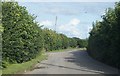
High hedges hide the farm
Passing through Higher West Town.
Image: © Fernweh
Taken: 3 Aug 2014
0.09 miles
2
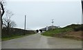
Apron and access to large farm building
Modern facilities for livestock to the north of Woolfardisworthy
Image: © David Smith
Taken: 21 Mar 2019
0.11 miles
3
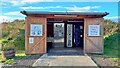
Woolsery milk vending machine
Since 2020, Higher West Town Farm has sold milk direct to the public through this state-of-the-art vending machine.
For those with a sweet tooth, there's a self-service milkshake bar.
Image: © Mark Percy
Taken: 29 Sep 2022
0.12 miles
4
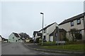
Auction Way, Woolfardisworthy
A small housing estate in the north-west of the village
Image: © David Smith
Taken: 21 Mar 2019
0.17 miles
5
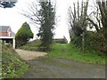
Public footpath in Woolfardisworthy
This provides a short cut from the main road to new houses in Auction Way
Image: © David Smith
Taken: 21 Mar 2019
0.20 miles
6
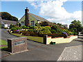
Bungalow and garden, Woolfardisworthy
Image: © Roger Cornfoot
Taken: 9 Aug 2016
0.23 miles