
IMAGES TAKEN NEAR TO
Upcott, BIDEFORD, EX39 5JQ
Introduction
This page details the photographs taken nearby to Upcott, EX39 5JQ by members of the Geograph project.
The Geograph project started in 2005 with the aim of publishing, organising and preserving representative images for every square kilometre of Great Britain, Ireland and the Isle of Man.

There are currently over 7.5m images from over14,400 individuals and you can help contribute to the project by visiting https://www.geograph.org.uk
Image Map
Images are licensed for reuse under creativecommons.org/licenses/by-sa/2.0
Notes
- Clicking on the map will re-center to the selected point.
- The higher the marker number, the further away the image location is from the centre of the postcode.
Image Listing (6 Images Found)
Images are licensed for reuse under creativecommons.org/licenses/by-sa/2.0
Image
Details
Distance
1
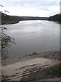
Steps by the River Torridge
Looking upstream towards the old railway bridge, which now carries the Tarke Trail.
Image: © Rod Allday
Taken: 5 Apr 2010
0.14 miles
2

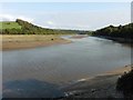
The River Torridge a short distance upstream from the town of Bideford
The iron bridge in the distance is the old railway bridge, now part of the course of the Tarka Trail.
Image: © Roger A Smith
Taken: 11 Aug 2013
0.15 miles
3
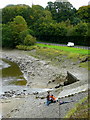
Angling by the stream outflow
The unnamed stream enters the Torridge from under the A386 which is clearly a good place for a spot of estuary fishing.
Image: © Jonathan Billinger
Taken: 7 Oct 2008
0.15 miles
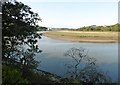
6

Bideford: towards East-the-Water
Looking north downstream from the bank of the river Torridge with Bideford Long Bridge and the more recent high-level A39 crossing in view
Image: © Martin Bodman
Taken: 21 Oct 2007
0.25 miles