
IMAGES TAKEN NEAR TO
Old Barnstaple Road, BIDEFORD, EX39 4NF
Introduction
This page details the photographs taken nearby to Old Barnstaple Road, EX39 4NF by members of the Geograph project.
The Geograph project started in 2005 with the aim of publishing, organising and preserving representative images for every square kilometre of Great Britain, Ireland and the Isle of Man.

There are currently over 7.5m images from over14,400 individuals and you can help contribute to the project by visiting https://www.geograph.org.uk
Image Map
Images are licensed for reuse under creativecommons.org/licenses/by-sa/2.0
Notes
- Clicking on the map will re-center to the selected point.
- The higher the marker number, the further away the image location is from the centre of the postcode.
Image Listing (10 Images Found)
Images are licensed for reuse under creativecommons.org/licenses/by-sa/2.0
Image
Details
Distance
1

Pillhead Farm
Now the site of several converted holiday cottages:
http://www.holidaycottages.co.uk/devon/north-devon/pillhead-cider-house
http://www.holidaycottages.co.uk/devon/north-devon/pillhead-garden-cottage
http://www.holidaycottages.co.uk/devon/north-devon/pillhead-corn-tallet
Image: © Stuart Shepherd
Taken: 3 Aug 2013
0.01 miles
2

View over Pillhead House
The house being lost amid the trees in the centre. This view looks right from where Image] was taken, over the lane past Southcott, with overlap involving Wearland and Weach Barton on the left. Pillhead Farm is on the right. The lien of trees above the foreground winding lane are along the Horwood Stream.
Image: © Derek Harper
Taken: 1 Dec 2019
0.05 miles
3
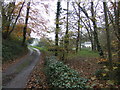
Lane to Pillhead
A small hamlet in a wooded valley east of Bideford.
Image: © Jonathan Billinger
Taken: 27 Nov 2007
0.06 miles
5

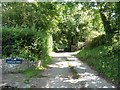
Old Milestone by Old Barnstaple Road, west of Pillhead Bridge
Carved stone post by the UC road, in parish of BIDEFORD (TORRIDGE District), Old Barnstaple Road, 30m West of boundary stone on small bridge (220m North East of entrance to Pillhead House), in bank, under hedge, part hidden in grass, on North side of road. Barum tombstone, erected by the Barnstaple turnpike trust in the 19th century.
Inscription reads:-
7
BARUM
1¼
BIDEFORD
Carved benchmark on middle face.
Grade II Listed. List Entry Number:1209839
https://historicengland.org.uk/listing/the-list/list-entry/1209839
Milestone Society National ID: DV_BFBS02
Image: © Alan Rosevear
Taken: 18 Feb 2013
0.12 miles
7

Old Boundary Marker by Old Barnstaple Road, Bideford Parish
Parish Boundary Marker by the UC road, in parish of Bideford (Torridge District), Old Barnstaple Road, on small bridge NE of drive to Pillhead, North parapet, cemented in.
Surveyed
Milestone Society National ID: DV_BFBS02pb
Image: © Alan Rosevear
Taken: 18 Feb 2013
0.14 miles
8

Wearland from Southcott
A view over the Horwood Stream valley from the lane between the farm at Soutcott and Southcott Cottages. Wearland, the farm in the centre, is clustered around the Old Barnstaple Road. Up on the right is Weach Barton, with a listed farmhouse on the right https://historicengland.org.uk/listing/the-list/list-entry/1325312. At top right distance is Woodtown.
Image: © Derek Harper
Taken: 1 Dec 2019
0.19 miles

10
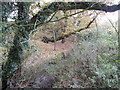
West of Pillhead Bridge
The small river is obscured by undergrowth.
Image: © Jonathan Billinger
Taken: 27 Nov 2007
0.23 miles