
IMAGES TAKEN NEAR TO
Instow, BIDEFORD, EX39 4LW
Introduction
This page details the photographs taken nearby to EX39 4LW by members of the Geograph project.
The Geograph project started in 2005 with the aim of publishing, organising and preserving representative images for every square kilometre of Great Britain, Ireland and the Isle of Man.

There are currently over 7.5m images from over14,400 individuals and you can help contribute to the project by visiting https://www.geograph.org.uk
Image Map
Images are licensed for reuse under creativecommons.org/licenses/by-sa/2.0
Notes
- Clicking on the map will re-center to the selected point.
- The higher the marker number, the further away the image location is from the centre of the postcode.
Image Listing (20 Images Found)
Images are licensed for reuse under creativecommons.org/licenses/by-sa/2.0
Image
Details
Distance
1
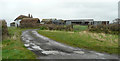
Day-o-peep
One of the more unusual names I've come across for a farm. This is a mile to the east of Instow.
Image: © Jonathan Billinger
Taken: 17 Jan 2008
0.02 miles
2
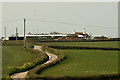
Day-O-Peep Farm on Downs Road
It is interesting to note that the Peep o' Day Boys was an agrarian Protestant association in 18th-century Ireland.
Image: © Roger A Smith
Taken: 11 Apr 2020
0.02 miles
3
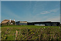
Day-O-Peep Farm
It is interesting to note that the Peep o' Day Boys was an agrarian Protestant association in 18th-century Ireland.
Image: © Roger A Smith
Taken: 11 Apr 2020
0.02 miles
4
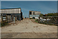
Day-O-Peep Farm
It is interesting to note that the Peep o' Day Boys was an agrarian Protestant association in 18th-century Ireland.
Image: © Roger A Smith
Taken: 11 Apr 2020
0.02 miles
6
Downs Road at Day-o-peep
A reminder of my First Geograph for this gridsquare taken in January 2008; Image
Image: © Jonathan Billinger
Taken: 16 Sep 2015
0.05 miles
8
One of two junctions named Worlington Cross
These two junctions are about 130 metres apart.
See also: Image
Image: © Roger A Smith
Taken: 11 Apr 2020
0.06 miles
9
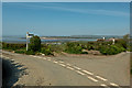
One of two junctions named Worlington Cross
These two junctions are about 130 metres apart.
See also: Image
Image: © Roger A Smith
Taken: 11 Apr 2020
0.11 miles
10

Worlington Hill fingerpost
Also the spot for a fine view across the Taw estuary.
Image: © Jonathan Billinger
Taken: 16 Sep 2015
0.11 miles