
IMAGES TAKEN NEAR TO
East The Water, BIDEFORD, EX39 4AQ
Introduction
This page details the photographs taken nearby to East The Water, EX39 4AQ by members of the Geograph project.
The Geograph project started in 2005 with the aim of publishing, organising and preserving representative images for every square kilometre of Great Britain, Ireland and the Isle of Man.

There are currently over 7.5m images from over14,400 individuals and you can help contribute to the project by visiting https://www.geograph.org.uk
Image Map
Images are licensed for reuse under creativecommons.org/licenses/by-sa/2.0
Notes
- Clicking on the map will re-center to the selected point.
- The higher the marker number, the further away the image location is from the centre of the postcode.
Image Listing (137 Images Found)
Images are licensed for reuse under creativecommons.org/licenses/by-sa/2.0
Image
Details
Distance
1

Houses on Ethelwynne Brown Close
The Tarka Trail running beside houses on Ethelwynne Brown Close in Bideford.
Image: © DS Pugh
Taken: 30 Jun 2025
0.02 miles
2

Tarka Trail beside Ethelwynne Brown Close
The gate gives access to Ethelwynne Brown Close in Bideford.
Image: © DS Pugh
Taken: 30 Jun 2025
0.02 miles
3
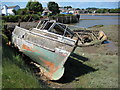
Abandoned boats on the River Torridge
Abandoned boats lie in the silt of the Torridge estuary at Bideford.
Image: © Philip Halling
Taken: 11 Jun 2009
0.04 miles
4

A derelict boat on the River Torridge at East the Water
Image: © Roger A Smith
Taken: 17 May 2018
0.05 miles
6

Wrecked boats on the River Torridge, Bideford
The river is obviously tidal at this point
Image: © Chris Allen
Taken: 3 Apr 2018
0.06 miles
7

Abandoned boats on the Torridge
The remains of abandoned boats rest in the Torridge estuary at Bideford, in the background is the Torridge Bridge carrying the A39.
Image: © Philip Halling
Taken: 11 Jun 2009
0.06 miles
8

A dead shrew on the Tarka Trail at Bideford
See also: Image
Image: © Roger A Smith
Taken: 24 Jul 2014
0.06 miles
9
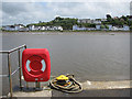
East-the-Water
Lies across the Torridge from Bideford.
Image: © Pauline E
Taken: 17 May 2009
0.07 miles
10
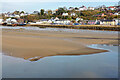
Torridge sand and mud
Viewed from Bideford Long Bridge. The river is tidal for a further 3 or 4 miles inland, in the vicinity of Weare Gifford at GR Image
Image: © John Lucas
Taken: 8 Feb 2023
0.09 miles