1
East-The-Water from Bideford Quay
Image: © Steve Daniels
Taken: 28 Jun 2009
0.01 miles
2
Rear of Royal Hotel, Bideford
The rear of the Royal Hotel forms a platform on the now dismantled London and South Western Railway Company line to Bideford. http://en.wikipedia.org/wiki/Bideford_railway_station
The trackbed now forms part of the Tarka Trail cycle path. http://www.devon.gov.uk/tarkatrail/
Note the old gas lights on the right-hand wall.
Image: © David P Howard
Taken: 7 Jul 2012
0.02 miles
3
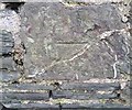
Ordnance Survey Cut Mark
This OS cut mark can be found on the wall SE side of Chudleigh Road. It marks a point 21.150m above mean sea level.
Image: © Adrian Dust
Taken: 5 Dec 2019
0.02 miles
4
The route of the Bideford to Barnstaple railway from Bideford station
The railway ceased to carry passengers in 1965, but continued in occasional use for goods until the 1980s. It was subsequently re-purposed to form the Tarka Trail walking and cycling route.
Image: © John Lucas
Taken: 8 Feb 2023
0.02 miles
5
The Royal Hotel, Bideford
The rear of the hotel showing the entrance from the platform of Bideford Station. The Tarka Trail runs through the old station.
Image: © Guy Wareham
Taken: 8 Jul 2019
0.02 miles
6
The Royal Hotel
The Royal Hotel stands on the eastern end of Bideford Long Bridge.
Image: © Philip Halling
Taken: 18 Feb 2012
0.02 miles
7
Bideford Railway Station
Now maintained by the Bideford Railway Heritage Centre.
Image: © Guy Wareham
Taken: 8 Jul 2019
0.02 miles
8
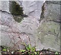
Ordnance Survey Cut Mark
This OS cut mark can be found on south face of the Station Hill Railway Bridge. It marks a point 7.114m above mean sea level.
Image: © Adrian Dust
Taken: 5 Dec 2019
0.02 miles
9
Cut Mark: Bideford, Station Hill Railway Bridge
Cut bench mark on the abutment north side of road, east side of former railway. The bridge is now carries the Tarka Trail. See https://www.geograph.org.uk/photo/7183957 for a wider view and https://www.bench-marks.org.uk/bm50178 for details of the mark.
Image: © Brian Westlake
Taken: 18 May 2022
0.02 miles
10
Tarka Trail Bridge over Station Street
The original railway bridge has been replaced by this structure carrying the Tarka Trail cycleway. A cut benchmark is on the angle of the near abutment. See https://www.geograph.org.uk/photo/7183953 for a closer view and https://www.bench-marks.org.uk/bm50178 for details of the mark.
Image: © Brian Westlake
Taken: 18 May 2022
0.02 miles


