
IMAGES TAKEN NEAR TO
Hyfield Place, BIDEFORD, EX39 2DW
Introduction
This page details the photographs taken nearby to Hyfield Place, EX39 2DW by members of the Geograph project.
The Geograph project started in 2005 with the aim of publishing, organising and preserving representative images for every square kilometre of Great Britain, Ireland and the Isle of Man.

There are currently over 7.5m images from over14,400 individuals and you can help contribute to the project by visiting https://www.geograph.org.uk
Image Map
Images are licensed for reuse under creativecommons.org/licenses/by-sa/2.0
Notes
- Clicking on the map will re-center to the selected point.
- The higher the marker number, the further away the image location is from the centre of the postcode.
Image Listing (588 Images Found)
Images are licensed for reuse under creativecommons.org/licenses/by-sa/2.0
Image
Details
Distance
1
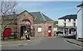
The Pannier Market, Bideford
This seems to be the usual name for a covered market in this part of Devon, and yet it implies traders selling goods from the panniers of pack-horses, in an open market place.
Image: © Humphrey Bolton
Taken: 8 Apr 2010
0.02 miles
2

Silver Street leading away from Meddon Street
Image: © Roger A Smith
Taken: 25 Jun 2010
0.03 miles
3

Silver Street, Bideford
Pictured on a very wet morning.
Image: © Jonathan Billinger
Taken: 14 Sep 2015
0.03 miles
4

The Lamb Inn, Bideford
On Honestone Street, a true back-street local.
The replaced window is ghastly.
Image: © Jonathan Billinger
Taken: 9 Oct 2008
0.03 miles
5
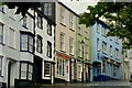
Colourful townhouses in Honestone Street
These buildings face the Pannier Market. The blue building is the Anchor Inn.
It may not look it but it is hissing with rain on this Monday morning.
Image: © Jonathan Billinger
Taken: 14 Sep 2015
0.03 miles
6
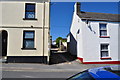
An entrance on Meddon street to The Trading Centre off from Honestone Street
Image: © Roger A Smith
Taken: 25 Jun 2010
0.04 miles
7

The Anchorage, on Meddon Street, which leads to Highfield Place
Image: © Roger A Smith
Taken: 25 Jun 2010
0.04 miles
8
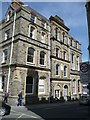
Bridge Buildings, Bridge Street, Bideford
Part of the council offices, opened in 1882. It has a sundial on the wall dated 1692; it was taken from Bridge Hall, which was previously on the site.
Image: © Humphrey Bolton
Taken: 8 Apr 2010
0.04 miles
9
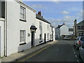
Honestone Street, Bideford
Looking east towards the town centre.
Image: © Jonathan Billinger
Taken: 9 Oct 2008
0.05 miles
10
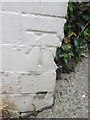
Ordnance Survey Cut Mark
This OS cut mark can be found on No13 Honestone Street. It marks a point 39.359m above mean sea level.
Image: © Adrian Dust
Taken: 13 Jul 2015
0.05 miles