IMAGES TAKEN NEAR TO
Higher Gunstone, BIDEFORD, EX39 2DG
Introduction
This page details the photographs taken nearby to Higher Gunstone, EX39 2DG by members of the Geograph project.
The Geograph project started in 2005 with the aim of publishing, organising and preserving representative images for every square kilometre of Great Britain, Ireland and the Isle of Man.

There are currently over 7.5m images from over14,400 individuals and you can help contribute to the project by visiting https://www.geograph.org.uk
Image Map
Images are licensed for reuse under creativecommons.org/licenses/by-sa/2.0
Notes
- Clicking on the map will re-center to the selected point.
- The higher the marker number, the further away the image location is from the centre of the postcode.
Image Listing (624 Images Found)
Images are licensed for reuse under creativecommons.org/licenses/by-sa/2.0
Image
Details
Distance
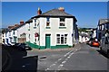
2

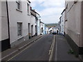
Pitt Hill - viewed from Higher Gunstone
Image: © Betty Longbottom
Taken: 9 May 2017
0.02 miles
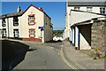
3
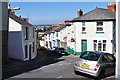
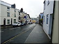
Coldharbour (ahead) leaves at the point where Higher Gunstone becomes Lower Gunstone
Torridge Bridge can be seen in the distance.
Image: © Roger A Smith
Taken: 25 Jun 2010
0.02 miles
4
Coldharbour (left) and Lower Gunstone (ahead)
Image: © Roger A Smith
Taken: 25 Jun 2010
0.02 miles
5
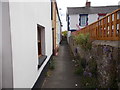
Old Town at the Junction with Pitt Lane (ahead) and Higher Gunstone (right)
Image: © Roger A Smith
Taken: 25 Jun 2010
0.03 miles
6
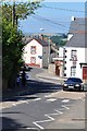
Old Town approaching the High Street (1st right), Coldharbour (2nd right) and Pitt Lane (Ahead)
Image: © Roger A Smith
Taken: 25 Jun 2010
0.03 miles

8

Ordnance Survey Cut Mark
This OS cut mark can be found on the wall NE side of Pitt Lane. It marks a point 33.726m above mean sea level.
Image: © Adrian Dust
Taken: 5 Dec 2019
0.03 miles