
IMAGES TAKEN NEAR TO
Churchill Way, BIDEFORD, EX39 1SU
Introduction
This page details the photographs taken nearby to Churchill Way, EX39 1SU by members of the Geograph project.
The Geograph project started in 2005 with the aim of publishing, organising and preserving representative images for every square kilometre of Great Britain, Ireland and the Isle of Man.

There are currently over 7.5m images from over14,400 individuals and you can help contribute to the project by visiting https://www.geograph.org.uk
Image Map
Images are licensed for reuse under creativecommons.org/licenses/by-sa/2.0
Notes
- Clicking on the map will re-center to the selected point.
- The higher the marker number, the further away the image location is from the centre of the postcode.
Image Listing (100 Images Found)
Images are licensed for reuse under creativecommons.org/licenses/by-sa/2.0
Image
Details
Distance
2
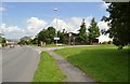
Northam Swimming Pool on Churchill Way
Image: © Roger A Smith
Taken: 5 Aug 2010
0.08 miles
3
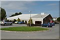
Northam Swimming Pool on Churchill Way
Image: © Roger A Smith
Taken: 5 Aug 2010
0.08 miles
4
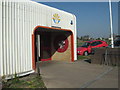
Torridge Pool, Northam, Main Entrance
The pool off Churchill Way opened to the public on 17th April 1987, with an official opening on 16th May. The pool was recently refurbished with new materials and an upstairs gym.
Image: © Sam
Taken: 27 Mar 2012
0.09 miles
5

Bus stop and shelter on Churchill Way, Northam
Image: © David Smith
Taken: 9 Jun 2014
0.11 miles
6
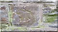
Ordnance Survey Cut Mark
This OS cut mark can be found on the wall of the chapel. It marks a point 52.109m above mean sea level.
Image: © Adrian Dust
Taken: 14 Feb 2017
0.13 miles
7
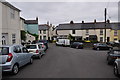
Northam : North Street
Looking towards North Street where it meets North East Street.
Image: © Lewis Clarke
Taken: 1 Jun 2014
0.14 miles
8
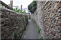
Northam : Footpath
A footpath heading from North East Street toward Cross Street.
Image: © Lewis Clarke
Taken: 1 Jun 2014
0.14 miles
9
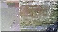
Ordnance Survey Cut Mark
This OS cut mark can be found on wall at No25 Fore Street. It marks a point 54.423m above mean sea level.
Image: © Adrian Dust
Taken: 14 Feb 2017
0.14 miles
10
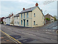
House at the corner of Lenards Road and Fore Street, Northam
Image: © Robin Stott
Taken: 29 Apr 2014
0.14 miles