
IMAGES TAKEN NEAR TO
Greysand Crescent, BIDEFORD, EX39 1SE
Introduction
This page details the photographs taken nearby to Greysand Crescent, EX39 1SE by members of the Geograph project.
The Geograph project started in 2005 with the aim of publishing, organising and preserving representative images for every square kilometre of Great Britain, Ireland and the Isle of Man.

There are currently over 7.5m images from over14,400 individuals and you can help contribute to the project by visiting https://www.geograph.org.uk
Image Map
Images are licensed for reuse under creativecommons.org/licenses/by-sa/2.0
Notes
- Clicking on the map will re-center to the selected point.
- The higher the marker number, the further away the image location is from the centre of the postcode.
Image Listing (146 Images Found)
Images are licensed for reuse under creativecommons.org/licenses/by-sa/2.0
Image
Details
Distance
1

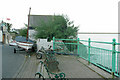
Irsha Street, Appledore
The back gardens of the houses on the north side of Irsha Street come right up to the edge of the low cliffs overlooking the sea shore. The southern edge of the grid square just about follows the right edge of the photo.
Image: © David P Howard
Taken: 7 Jul 2012
0.04 miles

4

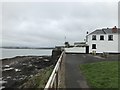
Coloured houses in Irsha Street, Appledore
Image: © David Martin
Taken: 16 Sep 2018
0.04 miles
6
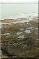
Foreshore, Appledore Pool
Looking to the left from the same spot as Image], with Crow Point across the water.
Image: © Derek Harper
Taken: 27 Sep 2016
0.04 miles
7
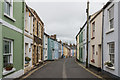
Irsha Street
Narrow street of colourful cottages following the shoreline of the Torridge Estuary. Irsha was once a hamlet separate from Appledore itself, with Irsha Street running the length of it. The houses date mainly from the 19th Century, but there are some earlier buildings.
Image: © Ian Capper
Taken: 19 Jun 2018
0.05 miles
8
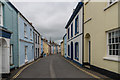
Irsha Street
Narrow street of colourful cottages following the shoreline of the Torridge Estuary. Irsha was once a hamlet separate from Appledore itself, with Irsha Street running the length of it. The houses date mainly from the 19th Century, but there are some earlier buildings.
Image: © Ian Capper
Taken: 19 Jun 2018
0.05 miles
9
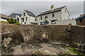
The Old Custom House
House on Western Hill, overlooking the slipway.
Image: © Ian Capper
Taken: 19 Jun 2018
0.05 miles
