
IMAGES TAKEN NEAR TO
Odun Place, BIDEFORD, EX39 1QP
Introduction
This page details the photographs taken nearby to Odun Place, EX39 1QP by members of the Geograph project.
The Geograph project started in 2005 with the aim of publishing, organising and preserving representative images for every square kilometre of Great Britain, Ireland and the Isle of Man.

There are currently over 7.5m images from over14,400 individuals and you can help contribute to the project by visiting https://www.geograph.org.uk
Image Map
Images are licensed for reuse under creativecommons.org/licenses/by-sa/2.0
Notes
- Clicking on the map will re-center to the selected point.
- The higher the marker number, the further away the image location is from the centre of the postcode.
Image Listing (274 Images Found)
Images are licensed for reuse under creativecommons.org/licenses/by-sa/2.0
Image
Details
Distance
1
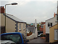
Green Lane, Appledore
An uphill, closely-packed part of the village, during a damp, gloomy spell.
Image: © Robin Stott
Taken: 29 Apr 2014
0.05 miles
2

Painted terrace houses
Painted terrace houses on Meeting Street in Appledore.
Image: © Philip Halling
Taken: 5 Nov 2017
0.05 miles
4
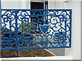
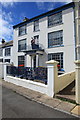
Ornate cast iron fence panel, Odun Road, Appledore
This is the frontage of the Maritime Museum, seen in Image
Image: © Robin Stott
Taken: 29 Apr 2014
0.06 miles
5
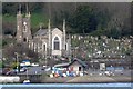
St Mary's Church, Appledore
Built in the 19th century
Image: © Roger A Smith
Taken: 27 Mar 2008
0.07 miles
6
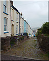
Alpha Place off Green Lane, Appledore
A well-kept terrace on an appreciable slope. Note the paving of stones worn smooth, and the coarse sandstone garden walls.
Image: © Robin Stott
Taken: 29 Apr 2014
0.08 miles
7
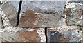
Ordnance Survey Cut Mark
This OS cut mark can be found on the outbuilding of the former Vicarage. It marks a point 26.783m above mean sea level.
Image: © Adrian Dust
Taken: 14 Feb 2017
0.09 miles
9
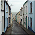
Looking down Bude Street, Appledore
A steep narrow street of stepped terraced houses. In the grey distance is Instow across the Torridge, on a damp and gloomy afternoon.
Image: © Robin Stott
Taken: 29 Apr 2014
0.09 miles
10
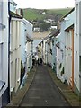
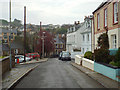
Bude Street, Appledore
Bude Street is a narrow street leading down to The Quay.
Image: © Philip Halling
Taken: 5 Nov 2017
0.09 miles