
IMAGES TAKEN NEAR TO
Lakenham Hill, BIDEFORD, EX39 1JH
Introduction
This page details the photographs taken nearby to Lakenham Hill, EX39 1JH by members of the Geograph project.
The Geograph project started in 2005 with the aim of publishing, organising and preserving representative images for every square kilometre of Great Britain, Ireland and the Isle of Man.

There are currently over 7.5m images from over14,400 individuals and you can help contribute to the project by visiting https://www.geograph.org.uk
Image Map
Images are licensed for reuse under creativecommons.org/licenses/by-sa/2.0
Notes
- Clicking on the map will re-center to the selected point.
- The higher the marker number, the further away the image location is from the centre of the postcode.
Image Listing (90 Images Found)
Images are licensed for reuse under creativecommons.org/licenses/by-sa/2.0
Image
Details
Distance
1

Ordnance Survey Cut Mark
This OS cut mark can be found on Greenbanks, Lakenham Road. It marks a point 42.957m above mean sea level.
Image: © Adrian Dust
Taken: 14 Feb 2017
0.05 miles
2
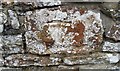
Ordnance Survey Cut Mark
This OS cut mark can be found on the wall NW side of Lakenham Road. It marks a point 41.912m above mean sea level.
Image: © Adrian Dust
Taken: 14 Feb 2017
0.08 miles
3
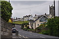
Northam : Sandymere Road
Looking along Sandymere Road as it heads up the hill.
Image: © Lewis Clarke
Taken: 1 Jun 2014
0.09 miles
4

A waste paper recycling skip in Bone Hill car park, Mondeville Way, Northam
Image: © Roger A Smith
Taken: 5 Apr 2015
0.10 miles
5
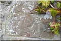
Ordnance Survey Cut Mark
This OS cut mark can be found on the wall of Clover Bank, Sandymere Road. It marks a point 32.227m above mean sea level.
Image: © Adrian Dust
Taken: 14 Feb 2017
0.10 miles
6

Northam : Sandymere Road
Looking along Sandymere Road as it heads through Northam.
Image: © Lewis Clarke
Taken: 1 Jun 2014
0.11 miles
7
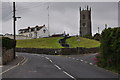
Northam : Sandymere Road
Looking along Sandymere Road as it heads through Northam.
Image: © Lewis Clarke
Taken: 1 Jun 2014
0.11 miles
8
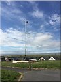
Bone Hill Memorial, Northam, Bideford
Image: © thejackrustles
Taken: 16 Jun 2021
0.12 miles
9
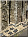
Location of OS Flush Bracket S5419 - Northam, Church
Image: © thejackrustles
Taken: 17 Jun 2021
0.13 miles
10

Ordnance Survey Cut Mark
This OS cut mark can be found on the gate post leading to St Margaret's Church. It marks a point 44.563m above mean sea level.
Image: © Adrian Dust
Taken: 14 Feb 2017
0.13 miles