
IMAGES TAKEN NEAR TO
Burwood Road, TORRINGTON, EX38 7NG
Introduction
This page details the photographs taken nearby to Burwood Road, EX38 7NG by members of the Geograph project.
The Geograph project started in 2005 with the aim of publishing, organising and preserving representative images for every square kilometre of Great Britain, Ireland and the Isle of Man.

There are currently over 7.5m images from over14,400 individuals and you can help contribute to the project by visiting https://www.geograph.org.uk
Image Map
Images are licensed for reuse under creativecommons.org/licenses/by-sa/2.0
Notes
- Clicking on the map will re-center to the selected point.
- The higher the marker number, the further away the image location is from the centre of the postcode.
Image Listing (6 Images Found)
Images are licensed for reuse under creativecommons.org/licenses/by-sa/2.0
Image
Details
Distance
2
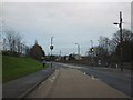
Hatchmoor Road pedestrian crossing
The road passes (on the left) the grounds and car park of Great Torrington Community School
Image: © David Smith
Taken: 26 Dec 2011
0.18 miles

4
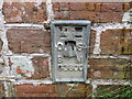
Ordnance Survey Flush Bracket G3800
This can be found on the wall of a house - private dwelling - in Hatchmoor.
For more detail see : http://www.bench-marks.org.uk/bm15379
Image: © Peter Wood
Taken: 2 Apr 2015
0.21 miles
5
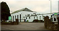
Great Torrington School
The southwestern end of the building shown in Image
Image: © Derek Harper
Taken: 1 Dec 2019
0.23 miles
6

Great Torrington School
Facing the B3232 Calvesford Road.
Image: © Derek Harper
Taken: 1 Dec 2019
0.24 miles