
IMAGES TAKEN NEAR TO
St. Giles, TORRINGTON, EX38 7JE
Introduction
This page details the photographs taken nearby to EX38 7JE by members of the Geograph project.
The Geograph project started in 2005 with the aim of publishing, organising and preserving representative images for every square kilometre of Great Britain, Ireland and the Isle of Man.

There are currently over 7.5m images from over14,400 individuals and you can help contribute to the project by visiting https://www.geograph.org.uk
Image Map
Images are licensed for reuse under creativecommons.org/licenses/by-sa/2.0
Notes
- Clicking on the map will re-center to the selected point.
- The higher the marker number, the further away the image location is from the centre of the postcode.
Image Listing (45 Images Found)
Images are licensed for reuse under creativecommons.org/licenses/by-sa/2.0
Image
Details
Distance
1
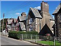
Former Stevenstone estate houses at St Giles in the Wood
Going north, the 19th century estate housing finishes with this rather grand terrace. It looks as though the nearest chimney breast has had to be rebuilt.
Image: © Chris Brown
Taken: 25 Sep 2018
0.08 miles
3
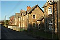
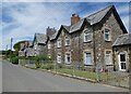
Listed houses, St Giles in The Wood
Further north along the line of estate village houses from Image On the immediate right are numbers 11 & 12 https://www.historicengland.org.uk/listing/the-list/list-entry/1104994 ; then come numbers 9 & 10 https://www.historicengland.org.uk/listing/the-list/list-entry/1147906 , where the "limestone plaque carved with the Rolle arms and bearing the date 1876" can just be made out beneath the larger central gable. Beyond is a terrace of four, numbers 5-8 https://www.historicengland.org.uk/listing/the-list/list-entry/1326604 . In all cases the front railings are included in the listing.
Image: © Derek Harper
Taken: 30 Nov 2016
0.09 miles
4
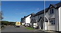
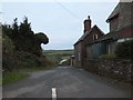
New houses at St Giles in the Wood
Built by Devon and Cornwall Housing Association under a planning consent granted in 2010 beside the road north out of the village. A traditional banked wall-cum-hedge with stones laid vertically at the base screens the houses and their access from the road itself.
Image: © Chris Brown
Taken: 25 Sep 2018
0.09 miles
6
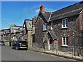
Estate housing at St Giles in the Wood
The nearest house is labelled Town Tenement Farm; beyond are terraced cottages with Gothic detailing, built for workers of the Stevenstone estate.
Image: © Chris Brown
Taken: 25 Sep 2018
0.12 miles
7
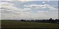
St Giles in the Wood from the north
Clearly "in the Wood" no longer. With Dartmoor on the distant horizon.
Image: © Chris Brown
Taken: 25 Sep 2018
0.13 miles
9
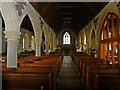
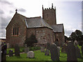
Interior, St Giles in The Wood Church
Image: © Roger Cornfoot
Taken: 11 Jul 2022
0.13 miles
10
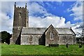
St. Giles in the Wood, St. Giles Church, southern aspect
Image: © Michael Garlick
Taken: 27 Sep 2018
0.14 miles