IMAGES TAKEN NEAR TO
TORRINGTON, EX38 7ET
Introduction
This page details the photographs taken nearby to EX38 7ET by members of the Geograph project.
The Geograph project started in 2005 with the aim of publishing, organising and preserving representative images for every square kilometre of Great Britain, Ireland and the Isle of Man.

There are currently over 7.5m images from over14,400 individuals and you can help contribute to the project by visiting https://www.geograph.org.uk
Image Map (Loading...)


Getting Data...Please wait
Leaflet Map data © OpenStreetMap
Images are licensed for reuse under creativecommons.org/licenses/by-sa/2.0
Notes
- Clicking on the map will re-center to the selected point.
- The higher the marker number, the further away the image location is from the centre of the postcode.
Image Listing (16 Images Found)
Images are licensed for reuse under creativecommons.org/licenses/by-sa/2.0
Image
Details
Distance

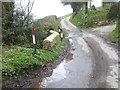


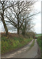
5
Road to Coombe Cross
Road to Coombe Cross to the north of Great Torrington.
Image: © Philip Halling
Taken: 11 Apr 2015
0.06 miles
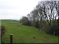
7

The road to Coombe Cross
Country lane from the B3232
Image: © John Myers
Taken: 3 Jun 2016
0.08 miles
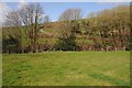
8

Road to Coombe Cross
A narrow road which is not suited to large vehicles
Image: © David Smith
Taken: 8 Oct 2015
0.14 miles
9
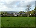
Conversion of covered reservoir, near Moortown
Image: © Roger Cornfoot
Taken: 28 Oct 2022
0.16 miles
10
Lane from Moortown
Looking left from Image] towards the junction with B3232.
Image: © Derek Harper
Taken: 1 Dec 2019
0.17 miles