
IMAGES TAKEN NEAR TO
Chittlehampton, UMBERLEIGH, EX37 9RU
Introduction
This page details the photographs taken nearby to EX37 9RU by members of the Geograph project.
The Geograph project started in 2005 with the aim of publishing, organising and preserving representative images for every square kilometre of Great Britain, Ireland and the Isle of Man.

There are currently over 7.5m images from over14,400 individuals and you can help contribute to the project by visiting https://www.geograph.org.uk
Image Map
Images are licensed for reuse under creativecommons.org/licenses/by-sa/2.0
Notes
- Clicking on the map will re-center to the selected point.
- The higher the marker number, the further away the image location is from the centre of the postcode.
Image Listing (11 Images Found)
Images are licensed for reuse under creativecommons.org/licenses/by-sa/2.0
Image
Details
Distance
1
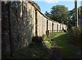
Path at East Stowford
A similar picture to Image, but the path (Swimbridge Footpath 9), which appears quite dry in that image, was extremely muddy this September.
Image: © Derek Harper
Taken: 26 Sep 2015
0.09 miles
2
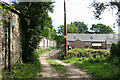
Swimbridge: East Stowford
Track and public footpath to Heywood and Chittlehampton. Looking south-south-east
Image: © Martin Bodman
Taken: 22 May 2007
0.09 miles
3
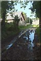
Path at East Stowford
A reverse view of Image] showing a very soggy Swimbridge Footpath 9.
Image: © Derek Harper
Taken: 26 Sep 2015
0.11 miles
4
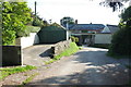
East Stowford
The lane from Swimbridge reaches a T junction in the hamlet, shown from a different direction in Image Beyond the junction is the listed Stowford House http://www.historicengland.org.uk/listing/the-list/list-entry/1107673 .
Image: © Derek Harper
Taken: 26 Sep 2015
0.11 miles
5
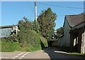
East Stowford
The lane junction at the hamlet. Left for Swimbridge, ahead into a maze of lanes and farms. The signpost gives an accurate impression of the nature of the terrain by sending you straight on (eastwards) to Filleigh and Chittlehampton, which are in opposite directions, north (well, ok, north-east) and south respectively. On the right is an outbuilding of Stowford Grange (listed as Stowford House).
Image: © Derek Harper
Taken: 26 Sep 2015
0.12 miles
6
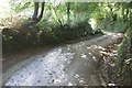
Lane to East Stowford
Sharp bends lead the lane from Swimbridge down through trees towards the hamlet.
Image: © Derek Harper
Taken: 26 Sep 2015
0.16 miles
7
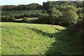
Footpath to the Hawkridge Brook
Swimbridge Footpath 9 follows a sunken area, doubtless an old track, down the side of the field. After crossing the stream, the path climbs between the old and new woodland on the far slope.
Image: © Derek Harper
Taken: 26 Sep 2015
0.17 miles
8

Duckboard by the Hawkridge Brook
It's extremely muddy here, and the duckboard provided for Swimbridge Footpath 9 as it leaves the footbridge over the stream no longer extends far enough, especially after recent wet weather.
Image: © Derek Harper
Taken: 26 Sep 2015
0.18 miles
9
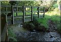
Footbridge over Hawkridge Brook
Carrying a footpath that changes from Chittlehampton Footpath 2 on this side to Swimbridge Footpath 9 on the other bank. This mystified me as the boundary between the two parishes is shown on most large-scale maps, including the 1:25000, as well over a kilometre to the north. However, the 1:10000 map shows it as running along the brook, and it turns out that the boundary was moved here in 2011. This must be a factor in the awful state of the footpath from this point into East Stowford.
Image: © Derek Harper
Taken: 26 Sep 2015
0.18 miles
10

Field at East Stowford
From Swimbridge Footpath 9 as it descends a steep hillside to the Hawkridge Brook.
Image: © Derek Harper
Taken: 26 Sep 2015
0.19 miles