
IMAGES TAKEN NEAR TO
Chittlehampton, UMBERLEIGH, EX37 9RE
Introduction
This page details the photographs taken nearby to EX37 9RE by members of the Geograph project.
The Geograph project started in 2005 with the aim of publishing, organising and preserving representative images for every square kilometre of Great Britain, Ireland and the Isle of Man.

There are currently over 7.5m images from over14,400 individuals and you can help contribute to the project by visiting https://www.geograph.org.uk
Image Map
Images are licensed for reuse under creativecommons.org/licenses/by-sa/2.0
Notes
- Clicking on the map will re-center to the selected point.
- The higher the marker number, the further away the image location is from the centre of the postcode.
Image Listing (15 Images Found)
Images are licensed for reuse under creativecommons.org/licenses/by-sa/2.0
Image
Details
Distance
2
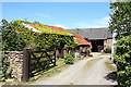
Chittlehampton: barns at Bradbury Cottages
Looking north-north-west by the lane to Riding Cross
Image: © Martin Bodman
Taken: 22 May 2007
0.01 miles
4
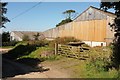
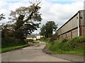
Barns at Bradbury Barton
Beside the more circuitous of the lanes between Bray Mill Cross and Milehouse Cottages. Chittlehampton Footpath 23 leaves on the right between the barns.
Image: © Derek Harper
Taken: 26 Sep 2015
0.13 miles
6
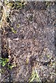
Ordnance Survey Rivet
This OS rivet can be found on the east parapet of the Bridge. It marks a point 79.583m above mean sea level.
Image: © Adrian Dust
Taken: 13 Feb 2017
0.13 miles
7
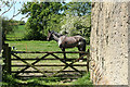
Chittlehampton: near North Bradbury
Looking west-south-west
Image: © Martin Bodman
Taken: 22 May 2007
0.14 miles
8
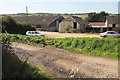
Bradbury Barton
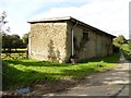
Farm buildings to the south of the farmhouse shown in Image
Image: © Derek Harper
Taken: 26 Sep 2015
0.14 miles
9
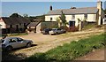
Bradbury Barton
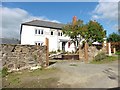
The listed farmhouse http://www.historicengland.org.uk/listing/the-list/list-entry/1117370 is "possibly late C16 in origins". The track I'm on is not the mapped route of Chittlehampton Footpath 23, which is shown as running past the corner of the building, but it seems to have been unofficially diverted.
Image: © Derek Harper
Taken: 26 Sep 2015
0.15 miles
10
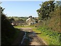
Bradbury Barton
Chittlehampton Footpath 23 follows this track past the listed farmhouse http://list.historicengland.org.uk/resultsingle.aspx?uid=1117370&searchtype=mapsearch .
Image: © Derek Harper
Taken: 26 Sep 2015
0.16 miles