
IMAGES TAKEN NEAR TO
Chittlehamholt, UMBERLEIGH, EX37 9PA
Introduction
This page details the photographs taken nearby to EX37 9PA by members of the Geograph project.
The Geograph project started in 2005 with the aim of publishing, organising and preserving representative images for every square kilometre of Great Britain, Ireland and the Isle of Man.

There are currently over 7.5m images from over14,400 individuals and you can help contribute to the project by visiting https://www.geograph.org.uk
Image Map
Images are licensed for reuse under creativecommons.org/licenses/by-sa/2.0
Notes
- Clicking on the map will re-center to the selected point.
- The higher the marker number, the further away the image location is from the centre of the postcode.
Image Listing (29 Images Found)
Images are licensed for reuse under creativecommons.org/licenses/by-sa/2.0
Image
Details
Distance
1

Cottages, Chittlehamholt
A view of the listed cottages http://list.english-heritage.org.uk/resultsingle.aspx?uid=1319486&searchtype=mapsearch shown in Image] from the other direction. On the left, also listed, is Searles http://list.english-heritage.org.uk/resultsingle.aspx?uid=1117076&searchtype=mapsearch .
Image: © Derek Harper
Taken: 22 Aug 2013
0.01 miles

3
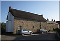
Cottages, Chittlehamholt
This row of cottages by the junction shown in Image] is listed http://list.english-heritage.org.uk/resultsingle.aspx?uid=1319486&searchtype=mapsearch .
Image: © Derek Harper
Taken: 22 Aug 2013
0.02 miles
4
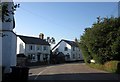
Junction, Chittlehamholt
Three roads meet; the one to the right leads to Warkleigh, the one to the left to the village church. Right of centre is The Old Gate House, shown in Image
Image: © Derek Harper
Taken: 22 Aug 2013
0.02 miles
5

Footpath, Chittlehamholt
Satterleigh and Warkleigh Footpath 28 leaves the main street in Chittlehamholt along this track, running past cottages.
Image: © Derek Harper
Taken: 22 Aug 2013
0.03 miles
6

Rethatching in the rain
Not a pleasant job in penetrating rain. Note the sign for the Exeter Inn above the roadsign for Portsmouth Arms.
Image: © Jonathan Billinger
Taken: 15 Jan 2008
0.05 miles
7

The Exeter Inn, Chittlehamholt
The inn sign recalls the days when this was a coaching inn on the Exeter - Barnstaple road. Chittlehamholt is a sleepy place nowadays, but the village pub is still at the centre of the community - even providing a public notice board.
Image: © Stephen McKay
Taken: 8 Nov 2007
0.05 miles
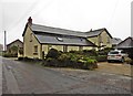
9
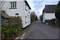
Chittlehamholt
Looking along the lane towards Chittlehampton. The house on the left is The Old Gate House.
Image: © Stephen McKay
Taken: 8 Nov 2007
0.06 miles
10

The Exeter Inn, Chittlehamholt
A classic thatched village pub, dating back to the 16th century. In the days when the road through Chittlehamholt was part of the main route between Exeter and Barnstaple, this was a coaching inn.
Image: © Stephen McKay
Taken: 8 Nov 2007
0.07 miles