IMAGES TAKEN NEAR TO
Burrington, UMBERLEIGH, EX37 9LA
Introduction
This page details the photographs taken nearby to EX37 9LA by members of the Geograph project.
The Geograph project started in 2005 with the aim of publishing, organising and preserving representative images for every square kilometre of Great Britain, Ireland and the Isle of Man.

There are currently over 7.5m images from over14,400 individuals and you can help contribute to the project by visiting https://www.geograph.org.uk
Image Map
Images are licensed for reuse under creativecommons.org/licenses/by-sa/2.0
Notes
- Clicking on the map will re-center to the selected point.
- The higher the marker number, the further away the image location is from the centre of the postcode.
Image Listing (41 Images Found)
Images are licensed for reuse under creativecommons.org/licenses/by-sa/2.0
Image
Details
Distance
1

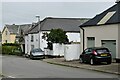
Twitchen Lane, Burrington
The lane passes the school playing field on the left and public conveniences (casting the shadow) on the right. At the bend is the junction with Meadow Park Drive, a residential cul-de-sac.
Image: © Derek Harper
Taken: 30 Nov 2016
0.05 miles
3
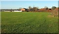
Burrington School Playing Field
From the gate on the left of Image The houses on the right are on Meadow Park Drive; the houses and garages on the left are on Pound Close. A radome at Burrington Radar Station can be seen on the horizon above a tree on the left.
Image: © Derek Harper
Taken: 30 Nov 2016
0.12 miles

6
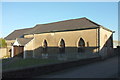
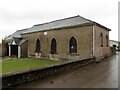
Bethesda Chapel, Burrington
Although I had a lovely sunny day for this image, the very low sun angle means that it is not really any clearer than Philip's image at Image The Methodist chapel is given the date of 1829 at http://northdevon.gov.uk/media/290583/li-list_burr-chulm.pdf .
Image: © Derek Harper
Taken: 30 Nov 2016
0.13 miles
7

Burrington: houses, pub and school
And, in the centre, the bus shelter. On the immediate left is the thatched Barnstaple Inn http://www.geograph.org.uk/search.php?i=67662893 https://www.historicengland.org.uk/listing/the-list/list-entry/1209790 . With a bell-cote is the Old School House http://northdevon.gov.uk/media/290583/li-list_burr-chulm.pdf .
Image: © Derek Harper
Taken: 30 Nov 2016
0.14 miles
8
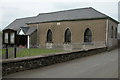
The Bethesda Chapel, Burrington
The Bethesda Chapel in Burrington dates from 1879.
Image: © Philip Halling
Taken: 14 May 2006
0.14 miles
9
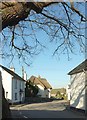
Barnstaple Inn, Burrington
Also shown at http://www.geograph.org.uk/search.php?i=67661634 , and described at https://www.historicengland.org.uk/listing/the-list/list-entry/1209790 . Seen here past cottages from beneath the oak tree in the centre of the village.
Image: © Derek Harper
Taken: 30 Nov 2016
0.14 miles