
IMAGES TAKEN NEAR TO
Burrington, UMBERLEIGH, EX37 9JG
Introduction
This page details the photographs taken nearby to EX37 9JG by members of the Geograph project.
The Geograph project started in 2005 with the aim of publishing, organising and preserving representative images for every square kilometre of Great Britain, Ireland and the Isle of Man.

There are currently over 7.5m images from over14,400 individuals and you can help contribute to the project by visiting https://www.geograph.org.uk
Image Map
Images are licensed for reuse under creativecommons.org/licenses/by-sa/2.0
Notes
- Clicking on the map will re-center to the selected point.
- The higher the marker number, the further away the image location is from the centre of the postcode.
Image Listing (43 Images Found)
Images are licensed for reuse under creativecommons.org/licenses/by-sa/2.0
Image
Details
Distance
1

Old Milestone in Burrington, opposite church entrance
Carved stone post by the UC road, in parish of BURRINGTON (NORTH DEVON District), opposite church entrance, beside shop wall, opposite Burrington Post Office, on pavement, leaning against wall, on North side of road. Barum tombstone, erected by the Barnstaple turnpike trust in the 19th century.
Inscription reads:-
13
BARUM
Milestone Society National ID: DV_BSLC13
Image: © Alan Rosevear
Taken: 13 Feb 2012
0.00 miles
2
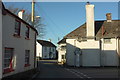
Junction, Burrington
The heart of the village, with a cul-de-sac on the right leading past the Methodist Chapel to a small industrial estate, and the L-shaped former London House Inn https://www.historicengland.org.uk/listing/the-list/list-entry/1325732 on the corner, and with sunny windows beyond. The parish church is just around to the left past the oak tree.
Image: © Derek Harper
Taken: 30 Nov 2016
0.01 miles
3
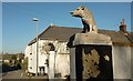
Boars, Burrington
Makes a change from lions, pineapples, eagles and balls, anyway. This is roughly opposite the Barnstaple Inn.
Image: © Derek Harper
Taken: 30 Nov 2016
0.01 miles
4
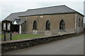
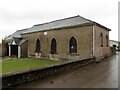
The Bethesda Chapel, Burrington
The Bethesda Chapel in Burrington dates from 1879.
Image: © Philip Halling
Taken: 14 May 2006
0.01 miles
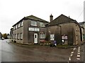
6

Old Oak Tree, Burrington
(No yellow ribbon visible).
Image: © Roger Cornfoot
Taken: 22 Oct 2020
0.01 miles
8
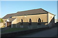
Bethesda Chapel, Burrington
Although I had a lovely sunny day for this image, the very low sun angle means that it is not really any clearer than Philip's image at Image The Methodist chapel is given the date of 1829 at http://northdevon.gov.uk/media/290583/li-list_burr-chulm.pdf .
Image: © Derek Harper
Taken: 30 Nov 2016
0.02 miles
10
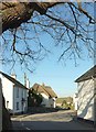
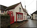
Barnstaple Inn, Burrington
Also shown at http://www.geograph.org.uk/search.php?i=67661634 , and described at https://www.historicengland.org.uk/listing/the-list/list-entry/1209790 . Seen here past cottages from beneath the oak tree in the centre of the village.
Image: © Derek Harper
Taken: 30 Nov 2016
0.02 miles