
IMAGES TAKEN NEAR TO
Mariansleigh, SOUTH MOLTON, EX36 4LW
Introduction
This page details the photographs taken nearby to EX36 4LW by members of the Geograph project.
The Geograph project started in 2005 with the aim of publishing, organising and preserving representative images for every square kilometre of Great Britain, Ireland and the Isle of Man.

There are currently over 7.5m images from over14,400 individuals and you can help contribute to the project by visiting https://www.geograph.org.uk
Image Map
Images are licensed for reuse under creativecommons.org/licenses/by-sa/2.0
Notes
- Clicking on the map will re-center to the selected point.
- The higher the marker number, the further away the image location is from the centre of the postcode.
Image Listing (16 Images Found)
Images are licensed for reuse under creativecommons.org/licenses/by-sa/2.0
Image
Details
Distance
1
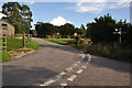
North Devon : Lower Uppacott Cross
A road heading through the countryside at Lower Uppacott.
Image: © Lewis Clarke
Taken: 15 Aug 2015
0.05 miles
3

Scots Pine mark tree at Uppacott
This tree is a landmark visible from miles around. Scots Pine trees were planted to mark farmsteads and drovers routes in the past.
Image: © Jenny Aker
Taken: 28 Dec 2006
0.07 miles
4

Mariansleigh: Lower Upcott
Looking east-south-east
Image: © Martin Bodman
Taken: 4 Nov 2006
0.07 miles
5
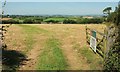
Towards Uppacott
From Uppacott Cross, looking through the northwest gateway. On the right is the Scots pine shown in Image
Image: © Derek Harper
Taken: 15 Aug 2016
0.07 miles
6
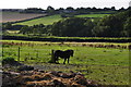
North Devon : Grassy Field & Pony
A pony in a field near Lower Uppacott.
Image: © Lewis Clarke
Taken: 15 Aug 2015
0.08 miles
7
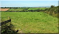
Farmland near Mariansleigh
A view from the lane west of Uppacott Cross, over a valley, with the village of Mariansleigh on the left.
Image: © Derek Harper
Taken: 15 Aug 2016
0.11 miles

9

Uppacott Cross
The signpost at the crossroads, just south of the farms at Uppacott. The road on the right takes the ridge route to Rose Ash.
Image: © Derek Harper
Taken: 15 Aug 2016
0.12 miles
10

Milltown Hill leading to Uppacott Cross
One arm of the signpost at the crossroads is visible Image The wide verge south of the crossroads is now a wildflower meadow; it suggests that the track was originally wider
Image: © David Smith
Taken: 19 Jun 2018
0.12 miles