IMAGES TAKEN NEAR TO
Nadder Lane, SOUTH MOLTON, EX36 4HH
Introduction
This page details the photographs taken nearby to Nadder Lane, EX36 4HH by members of the Geograph project.
The Geograph project started in 2005 with the aim of publishing, organising and preserving representative images for every square kilometre of Great Britain, Ireland and the Isle of Man.

There are currently over 7.5m images from over14,400 individuals and you can help contribute to the project by visiting https://www.geograph.org.uk
Image Map
Images are licensed for reuse under creativecommons.org/licenses/by-sa/2.0
Notes
- Clicking on the map will re-center to the selected point.
- The higher the marker number, the further away the image location is from the centre of the postcode.
Image Listing (46 Images Found)
Images are licensed for reuse under creativecommons.org/licenses/by-sa/2.0
Image
Details
Distance
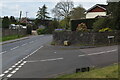
2
South Molton : Gunswell Lane
A small road off Gunswell Lane.
Image: © Lewis Clarke
Taken: 15 Dec 2021
0.09 miles
3

Quince Honey farm on North West corner of South Molton
Image: © Ivan Taylor
Taken: 23 Nov 2005
0.11 miles
4

South Molton : Frog Lane
Looking to path of grassy area known as Frog Lane.
Image: © Lewis Clarke
Taken: 15 Dec 2021
0.12 miles
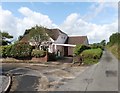
5
South Molton : Nadder Meadon
Nadder Meadon in the town of South Molton.
Image: © Lewis Clarke
Taken: 9 Aug 2013
0.12 miles
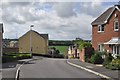
8
Nadder Meadow, South Molton
Part of a housing estate on the western edge of South Molton, on the south side of Nadder Lane
Image: © David Smith
Taken: 9 Jun 2014
0.13 miles
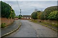
9
Gunswell Lane
New housing is being constructed above the bank on the right.
Image: © David Martin
Taken: 24 Apr 2023
0.14 miles
10
A Mercedes 313 cdi on the back of an Isuzu N75 190 recovery truck in West Street
Image: © Roger A Smith
Taken: 20 Apr 2015
0.15 miles