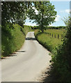
IMAGES TAKEN NEAR TO
SOUTH MOLTON, EX36 3EJ

Introduction

This page details the photographs taken nearby to EX36 3EJ by members of the Geograph project.

The Geograph project started in 2005 with the aim of publishing, organising and preserving representative images for every square kilometre of Great Britain, Ireland and the Isle of Man.

There are currently over 7.5m images from over14,400 individuals and you can help contribute to the project by visiting https://www.geograph.org.uk

Image Map


Images are licensed for reuse under creativecommons.org/licenses/by-sa/2.0
Notes
  • Clicking on the map will re-center to the selected point.
  • The higher the marker number, the further away the image location is from the centre of the postcode.

Image Listing (15 Images Found)

Images are licensed for reuse under creativecommons.org/licenses/by-sa/2.0
Image
Details
Distance
1
Children 10 mph please, Nadrid
Not clear for how long they are expected to maintain that speed; a tall order for the younger ones, I would say. This is at the entrance to Ash Park Farm.
Image: © Derek Harper Taken: 22 Jun 2019
0.07 miles
2
Lane to South Leigh Cross
From the same spot as Image], looking left.
Image: © Derek Harper Taken: 22 Jun 2019
0.08 miles
3
Ordnance Survey Flush Bracket (11192)
This OS cut mark can be found on the roadside barn at Nadrid Farm. It marks a point 191.551m above mean sea level.
Image: © Adrian Dust Taken: 17 Oct 2015
0.12 miles
4
Nadrid Farm
Image: © Roger Cornfoot Taken: 26 Nov 2018
0.12 miles
5
Ordnance Survey Flush Bracket 11192
This can be found on the wall of a building at Nadrid Farm. For more detail see : http://www.bench-marks.org.uk/bm22135
Image: © Peter Wood Taken: 1 Apr 2015
0.13 miles
6
North Molton: Nadrid
A farmhouse by a lane to North Molton village at a junction with a second lane from South Molton. Looking east-north-east
Image: © Martin Bodman Taken: 11 Apr 2007
0.13 miles
7
Nadrid Cross
Image: © Sarah Charlesworth Taken: 14 Feb 2010
0.15 miles
8
Nadrid Cross
Near to Nadrid Farm and the head of the stream, Nadrid Water
Image: © David Smith Taken: 16 Feb 2018
0.15 miles
9
North Molton : A399
Looking along the A399.
Image: © Lewis Clarke Taken: 8 Jun 2023
0.18 miles
10
North Molton : A399
Looking along the A399.
Image: © Lewis Clarke Taken: 8 Jun 2023
0.19 miles