IMAGES TAKEN NEAR TO
LYNTON, EX35 6AN

Introduction

This page details the photographs taken nearby to EX35 6AN by members of the Geograph project.

The Geograph project started in 2005 with the aim of publishing, organising and preserving representative images for every square kilometre of Great Britain, Ireland and the Isle of Man.

There are currently over 7.5m images from over14,400 individuals and you can help contribute to the project by visiting https://www.geograph.org.uk

Image Map


Images are licensed for reuse under creativecommons.org/licenses/by-sa/2.0
Notes
  • Clicking on the map will re-center to the selected point.
  • The higher the marker number, the further away the image location is from the centre of the postcode.

Image Listing (605 Images Found)

Images are licensed for reuse under creativecommons.org/licenses/by-sa/2.0
  • ...
Image
Details
Distance
1
Blackmore's Path
A narrow back passage a little way up the hill.
Image: © Bill Boaden Taken: 2 Jul 2017
0.01 miles
2
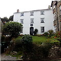
Victoria House, Lynton
Early 19th century house set back from, and above, the south side of Lydiate Lane. Grade II listed in 1973.
Image: © Jaggery Taken: 24 Sep 2014
0.01 miles
3
Looking up Lydiate Lane from junction with Queen Street
Image: © Basher Eyre Taken: 4 Aug 2008
0.01 miles
4
Orchard Terrace, Lynton
A row of four houses at the eastern end of Lydiate Lane, near the corner of Sinai Hill.
Image: © Jaggery Taken: 24 Sep 2014
0.01 miles
5
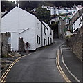
Eastern end of Lydiate Lane, Lynton
Lydiate Lane climbs away from the broken white lines at the Sinai Hill junction.
Image: © Jaggery Taken: 24 Sep 2014
0.01 miles
6
The Fernery, Lynton
A short flight of steps connects The Fernery B&B guest house with Lydiate Lane. Victoria House http://www.geograph.org.uk/photo/4182200 is on the left.
Image: © Jaggery Taken: 24 Sep 2014
0.02 miles
7
Sinai Hill, Lynton
Viewed from near an entrance to the Crown Hotel. http://www.geograph.org.uk/photo/4182203
Image: © Jaggery Taken: 24 Sep 2014
0.02 miles
8
Lynton Public Market Hall
This building now houses the public library.
Image: © Rod Allday Taken: 3 Apr 2009
0.02 miles
9
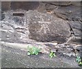
Ordnance Survey Cut Mark
This OS cut mark can be found on No1 Waverley Terrace. It marks a point 130.451m above mean sea level.
Image: © Adrian Dust Taken: 23 Nov 2018
0.02 miles
10
Sinai Hill entrance to The Crown Hotel and Ale House, Lynton
At the bottom of Sinai Hill, near the Lydiate Lane junction. The postbox in the wall is Victorian. http://www.geograph.org.uk/photo/4182205
Image: © Jaggery Taken: 24 Sep 2014
0.02 miles
  • ...