
IMAGES TAKEN NEAR TO
Hagginton Hill, ILFRACOMBE, EX34 9SB
Introduction
This page details the photographs taken nearby to Hagginton Hill, EX34 9SB by members of the Geograph project.
The Geograph project started in 2005 with the aim of publishing, organising and preserving representative images for every square kilometre of Great Britain, Ireland and the Isle of Man.

There are currently over 7.5m images from over14,400 individuals and you can help contribute to the project by visiting https://www.geograph.org.uk
Image Map
Images are licensed for reuse under creativecommons.org/licenses/by-sa/2.0
Notes
- Clicking on the map will re-center to the selected point.
- The higher the marker number, the further away the image location is from the centre of the postcode.
Image Listing (31 Images Found)
Images are licensed for reuse under creativecommons.org/licenses/by-sa/2.0
Image
Details
Distance
1

Berrynarbor : Hagginton Hill
Looking across the village.
Image: © Lewis Clarke
Taken: 27 Feb 2021
0.02 miles

3
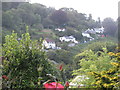
View from The Garden Room at The Lodge
Image: © Josie Campbell
Taken: 30 Aug 2014
0.11 miles
4
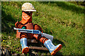
Berrynarbor : Flowerpot Man
They're taking the lockdown rules very seriously in the village.
Image: © Lewis Clarke
Taken: 27 Feb 2021
0.11 miles
6
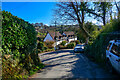
Berrynarbor : Hagginton Hill
Looking along the road.
Image: © Lewis Clarke
Taken: 27 Feb 2021
0.13 miles
7
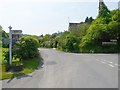
Entering Berrynarbor from the North after leaving the A399.
Image: © Roger A Smith
Taken: 11 May 2008
0.13 miles
8
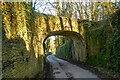
Berrynarbor : Hagginton Hill
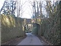
The Grade II listed bridge was erected by the Basset family to provide private access from Watermouth Castle (q.v.) to the village of Berrynarbour.
Image: © Lewis Clarke
Taken: 27 Feb 2021
0.13 miles
9

East Haggington Farm on the Berrynarbor road.
Image: © Roger A Smith
Taken: 11 May 2008
0.13 miles
10

Berrynarbor : Hagginton Hill
Looking along the hill.
Image: © Lewis Clarke
Taken: 27 Feb 2021
0.14 miles