
IMAGES TAKEN NEAR TO
Quayfield Road, ILFRACOMBE, EX34 9EN
Introduction
This page details the photographs taken nearby to Quayfield Road, EX34 9EN by members of the Geograph project.
The Geograph project started in 2005 with the aim of publishing, organising and preserving representative images for every square kilometre of Great Britain, Ireland and the Isle of Man.

There are currently over 7.5m images from over14,400 individuals and you can help contribute to the project by visiting https://www.geograph.org.uk
Image Map
Images are licensed for reuse under creativecommons.org/licenses/by-sa/2.0
Notes
- Clicking on the map will re-center to the selected point.
- The higher the marker number, the further away the image location is from the centre of the postcode.
Image Listing (1014 Images Found)
Images are licensed for reuse under creativecommons.org/licenses/by-sa/2.0
Image
Details
Distance
1

The Manor House, Ilfracombe
Grade II listed and built between the 1750's and 1770's, this was the town house of the Wreys of Tawstock who were Lords of the Manor.
Image: © David Rogers
Taken: 1 Sep 2018
0.01 miles
2
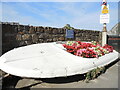
Continuing to make a smile
The flower-bearing boat is a long-term feature by the harbour and is related to the hospital charity Make Me Smile.
Image: © Neil Owen
Taken: 9 Aug 2022
0.01 miles
3
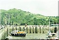
Inner Harbour at low tide, Ilfracombe
In the background is Hillsborough Hill, in the next km square east.
Image: © Alan Cooper
Taken: 13 Jun 2006
0.01 miles
4

Grey cabinet below Quayfield Road, Ilfracombe
The cabinet is an electricity substation alongside a wall below Quayfield Road.
Image: © Jaggery
Taken: 24 Jun 2017
0.02 miles
5
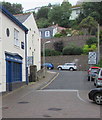
RNLI Ilfracombe
Viewed across Broad Street, this is the blue and white back of the RNLI Lifeboat Station facing the harbour.
RNLI is the acronym on the Royal National Lifeboat Institution,
an independent charity which does not receive any funding from the UK government.
Image: © Jaggery
Taken: 24 Jun 2017
0.02 miles
6
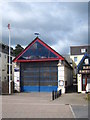
Ilfracombe lifeboat station
Housing a Mersey Class all-weather lifeboat and a D Class inshore rescue boat.
Image: © Rod Allday
Taken: 25 Sep 2010
0.02 miles
7
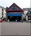
RNLI Ilfracombe Lifeboat Station
RNLI is the acronym of Royal National Lifeboat Institution.
Harbour Amusements is on the right.
Image: © Jaggery
Taken: 24 Jun 2017
0.02 miles
8
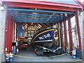
Ilfracombe lifeboat station
Ilfracombe has a long history of sea rescue. A boat was organised by local people as early as 1828, but an officially recognised service began here in 1866 when a boathouse was built for £180. Over the intervening years, the station has witnessed many instances of heroism and tragedy along the treacherous North Devon coastline.
Most recently, this boathouse was built in 1996 and now accommodates the latest vessel - a Shannon class Search and Rescue vessel, poised on its tracked carrier.
Image: © Neil Owen
Taken: 9 Aug 2022
0.02 miles
9
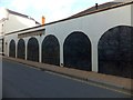
Wall panels by Roger Dean, Ilfracombe
This set of six wall panels are sculpted in low relief by the Exeter-based artist, Roger Dean. Other examples of his work can be found in Moretonhampstead Image, Hatherleigh Image and Exeter Image
Image: © David Smith
Taken: 19 Aug 2013
0.02 miles
10
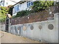
Rolling in the money
A house overlooking the harbour has a rich sense of style. See Image] for another pocketful.
Image: © Neil Owen
Taken: 9 Aug 2022
0.03 miles