IMAGES TAKEN NEAR TO
Trimstone, ILFRACOMBE, EX34 8NR
Introduction
This page details the photographs taken nearby to Trimstone, EX34 8NR by members of the Geograph project.
The Geograph project started in 2005 with the aim of publishing, organising and preserving representative images for every square kilometre of Great Britain, Ireland and the Isle of Man.

There are currently over 7.5m images from over14,400 individuals and you can help contribute to the project by visiting https://www.geograph.org.uk
Image Map
Images are licensed for reuse under creativecommons.org/licenses/by-sa/2.0
Notes
- Clicking on the map will re-center to the selected point.
- The higher the marker number, the further away the image location is from the centre of the postcode.
Image Listing (18 Images Found)
Images are licensed for reuse under creativecommons.org/licenses/by-sa/2.0
Image
Details
Distance
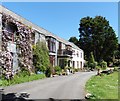
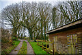
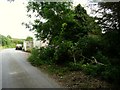
1
A track leading off from the road to Trimstone
Image: © Roger A Smith
Taken: 24 Jul 2009
0.01 miles
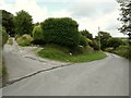
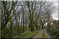
4
West Down : Track
A track in the countryside.
Image: © Lewis Clarke
Taken: 16 Jan 2021
0.03 miles
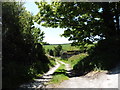
7
West Down : Track
A track heads through the countryside.
Image: © Lewis Clarke
Taken: 16 Jan 2021
0.07 miles
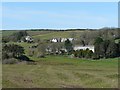
8
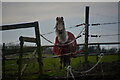
West Down : Grassy Field & Horse
A horse in a field.
Image: © Lewis Clarke
Taken: 16 Jan 2021
0.07 miles
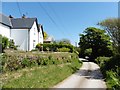
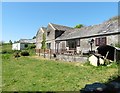
9
Passing an isolated house on the road to Trimstone
Image: © Roger A Smith
Taken: 24 Jul 2009
0.08 miles