
IMAGES TAKEN NEAR TO
Franklyn Avenue, BRAUNTON, EX33 2JY
Introduction
This page details the photographs taken nearby to Franklyn Avenue, EX33 2JY by members of the Geograph project.
The Geograph project started in 2005 with the aim of publishing, organising and preserving representative images for every square kilometre of Great Britain, Ireland and the Isle of Man.

There are currently over 7.5m images from over14,400 individuals and you can help contribute to the project by visiting https://www.geograph.org.uk
Image Map
Images are licensed for reuse under creativecommons.org/licenses/by-sa/2.0
Notes
- Clicking on the map will re-center to the selected point.
- The higher the marker number, the further away the image location is from the centre of the postcode.
Image Listing (107 Images Found)
Images are licensed for reuse under creativecommons.org/licenses/by-sa/2.0
Image
Details
Distance
1
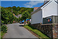
Braunton : Franklyn Avenue
Looking along Franklyn Avenue off Lower Park Road.
Image: © Lewis Clarke
Taken: 20 Jun 2020
0.05 miles
2
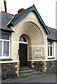
Elliott Gallery, Hills View
Through this impressive entrance, constructed from cream marland brick, is the gallery exhibiting pastels and prints by Walter Elliott as well as art, craft-work and sculpture from across the UK. www.elliottartgallery.co.uk
Image: © Rabbi WP Thinrod
Taken: 20 Mar 2008
0.07 miles
3
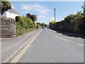
Lower Park Road - viewed from Hills View
Image: © Betty Longbottom
Taken: 10 May 2017
0.07 miles
4

Bloomfield House
Self Catering Establishment.
Image: © William Bedell
Taken: 9 Sep 2007
0.07 miles
5

Hills View - viewed from Lower Park Road
Image: © Betty Longbottom
Taken: 10 May 2017
0.08 miles
6
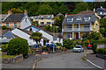
Braunton : Springfield Close
Springfield Close off Lower Park Road.
Image: © Lewis Clarke
Taken: 20 Jun 2020
0.08 miles
7

Ordnance Survey Flush Bracket S2810
This can be found on the wall of a private dwelling in Braunton.
For more detail see : http://www.bench-marks.org.uk/bm16175
Image: © Peter Wood
Taken: 3 Apr 2015
0.08 miles
8

Old Direction Sign - Signpost by Wrafton Road, Braunton parish
Pyramid cap finial - 2 arms; Devon DCC pyramid by the UC road (was A361), in parish of Braunton (North Devon District), Wrafton Road junction with Heanton Street, on grass beside park entrance.
Devon & Dartmoor HER.
HER Number: MDV73847 https://www.heritagegateway.org.uk/Gateway/Results_Single.aspx?uid=MDV73847&resourceID=104
Surveyed
Milestone Society National ID: DV_SS4836
Image: © Alan Rosevear
Taken: 8 Feb 2013
0.10 miles
9
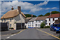
Braunton : Heanton Street
Looking along Heanton Street off Wrafton Lane.
Image: © Lewis Clarke
Taken: 20 Jun 2020
0.10 miles
10

Braunton : Brittons Close
Brittons Close off Wrafton Road.
Image: © Lewis Clarke
Taken: 20 Jun 2020
0.10 miles