IMAGES TAKEN NEAR TO
Saunton Road, BRAUNTON, EX33 1HB
Introduction
This page details the photographs taken nearby to Saunton Road, EX33 1HB by members of the Geograph project.
The Geograph project started in 2005 with the aim of publishing, organising and preserving representative images for every square kilometre of Great Britain, Ireland and the Isle of Man.

There are currently over 7.5m images from over14,400 individuals and you can help contribute to the project by visiting https://www.geograph.org.uk
Image Map (Loading...)


Getting Data...Please wait
Leaflet Map data © OpenStreetMap
Images are licensed for reuse under creativecommons.org/licenses/by-sa/2.0
Notes
- Clicking on the map will re-center to the selected point.
- The higher the marker number, the further away the image location is from the centre of the postcode.
Image Listing (117 Images Found)
Images are licensed for reuse under creativecommons.org/licenses/by-sa/2.0
Image
Details
Distance
2
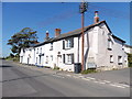
Braunton : Caen Street B3231
Looking along Caen Street.
Image: © Lewis Clarke
Taken: 9 Jan 2021
0.02 miles
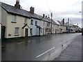
3
Braunton : Sharland's Lane
Looking along Sharland's Lane.
Image: © Lewis Clarke
Taken: 9 Jan 2021
0.05 miles
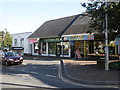
4
Field Lane
Field Lane passing Second Field Lane
Image: © Shaun Ferguson
Taken: 23 Sep 2020
0.06 miles
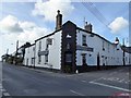
6
Braunton : Caen Street B3231
Passing alongside The White Lion.
Image: © Lewis Clarke
Taken: 9 Jan 2021
0.08 miles
7

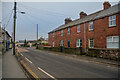
Braunton : Chapel Street
Looking along Chapel Street.
Image: © Lewis Clarke
Taken: 9 Jan 2021
0.08 miles
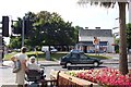
8
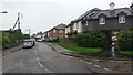
Saunton Road, Braunton
Looking towards Braunton village on a showery April morning.
Image: © Sue Sandy
Taken: 11 Apr 2008
0.08 miles
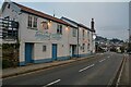
10
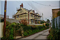
Braunton village centre
The building opposite, now a newsagents, was once the village railway station. The tree opposite, which has grown since the line was demolished in the mid-1970s, is on the line of the tracks which crossed the road where the pelican crossing is.
Image: © Ron Strutt
Taken: 2 Sep 2003
0.10 miles