
IMAGES TAKEN NEAR TO
Newport Road, BARNSTAPLE, EX32 9LQ
Introduction
This page details the photographs taken nearby to Newport Road, EX32 9LQ by members of the Geograph project.
The Geograph project started in 2005 with the aim of publishing, organising and preserving representative images for every square kilometre of Great Britain, Ireland and the Isle of Man.

There are currently over 7.5m images from over14,400 individuals and you can help contribute to the project by visiting https://www.geograph.org.uk
Image Map
Images are licensed for reuse under creativecommons.org/licenses/by-sa/2.0
Notes
- Clicking on the map will re-center to the selected point.
- The higher the marker number, the further away the image location is from the centre of the postcode.
Image Listing (105 Images Found)
Images are licensed for reuse under creativecommons.org/licenses/by-sa/2.0
Image
Details
Distance
1

The Rose and Crown public house - now Mews apartments (Newport Road)
The Rose and Crown public house is located at the eastern end of Newport Road in Barnstaple, Devon, at the junction with South Street. The Site (centred on NGR SS 56741 32189) occupies an area of land in the south of the town originated as a 16th or 17th century house. Which is Grade II listed building (List entry no. 1385245; HER no. MDV43065).
Image: © David Meredith
Taken: 2 Jan 2017
0.01 miles
2
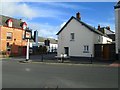
The Rose and Crown public house - Now Mews apartments (South Street)
The Rose and Crown public house is located at the eastern end of Newport Road in Barnstaple, Devon at the junction with South Street. The Site (centred on NGR SS 56741 32189) occupies an area of land in the south of the town originated as a 16th or 17th century house. Which is Grade II listed building (List entry no. 1385245; HER no. MDV43065).
Image: © David Meredith
Taken: 13 Jan 2017
0.01 miles
3

The Corner Shop, Newport Road, Barnstaple
Image: © Robert Eva
Taken: 28 Jul 2017
0.03 miles
7
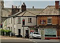
The Corner Shop, 54/55 Newport road, Barnstaple
More recently this premises was a member of the Costcutter franchise.
Image: © Roger A Smith
Taken: 16 Jun 2016
0.03 miles
8
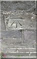
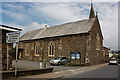
Ordnance Survey Cut Mark
This OS cut mark can be found on the SE face of the Newport Methodist Church. It marks a point 22.9331m above mean sea level.
Image: © Adrian Dust
Taken: 4 Jul 2016
0.04 miles
9
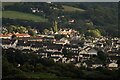
Houses in Newport, Barnstaple, and the outskirts of Bishops Tawton
Image: © Roger A Smith
Taken: 27 Aug 2023
0.04 miles
10
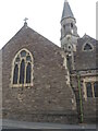
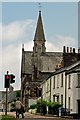
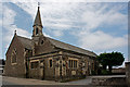
St John on South Street
The church stands on a former chapel of ease and was built in 1829. However, as Barnstaple grew and needs increased, the building was in dire condition. Massive reparations were made and the present structures were opened in 1882.
A benchmark can be found at street level - see Image
Image: © Neil Owen
Taken: 9 Jun 2023
0.04 miles